1
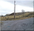
Narrow southern section of Waun Ebbw Road, Nantyglo
Behind the camera, there is a 90-degree bend in the main road from NW-SE to a SW-NE orientation. Waun Ebbw Road, now narrower, continues as a minor road heading SE.
The houses look out across moorland. http://www.geograph.org.uk/photo/2281109
Image: © Jaggery
Taken: 3 Feb 2011
0.05 miles
2
Looking NW along Waun Ebbw Road, Nantyglo
The view NW from the edge of a 90-degree bend in the road. A narrower Waun Ebbw Road http://www.geograph.org.uk/photo/2281094 continues heading SE past the camera (bottom left corner of view).
Image: © Jaggery
Taken: 3 Feb 2011
0.05 miles
3
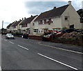
Waun Ebbw Road houses, Nantyglo
Houses on the east side of the road, facing the turning for Waun Ebbw Bungalows. http://www.geograph.org.uk/photo/2281067
Image: © Jaggery
Taken: 3 Feb 2011
0.05 miles
4
SE corner of Waun Ebbw Bungalows Nantyglo
Viewed across Waun Ebbw Road.
Image: © Jaggery
Taken: 18 Sep 2013
0.08 miles
5
Bus stops adjacent to Roundhouse Close, Nantyglo
The bus stops are on an unnamed section of road between Waun Ebbw Road and the T-junction (out of shot ahead) with Chapel Road/New Road. The turning into Roundhouse Close is on the right, near the triangular white side of a building.
Image: © Jaggery
Taken: 3 Feb 2011
0.09 miles
6
Corner of Roundhouse Close, Nantyglo
Viewed from an unnamed section of main road. http://www.geograph.org.uk/photo/2281137
Image: © Jaggery
Taken: 3 Feb 2011
0.09 miles
7
Moorland viewed from Waun Ebbw Road, Nantyglo
Houses on the southern section of Waun Ebbw Road http://www.geograph.org.uk/photo/2281094 have this view of former mining waste tips, at an elevation of about 350 metres (1150 feet) above sea level.
Image: © Jaggery
Taken: 3 Feb 2011
0.11 miles
8
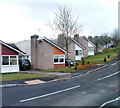
Waun Ebbw Bungalows, Nantyglo
An area of distinctively-shaped bungalows on the west side of Waun Ebbw Road.
Image: © Jaggery
Taken: 3 Feb 2011
0.11 miles
9
Waun Ebbw bungalows, Nantyglo
Distinctively-shaped bungalows on the west side of Waun Ebbw Road.
Image: © Jaggery
Taken: 18 Sep 2013
0.13 miles
10
Waun Ebbw Road houses Nantyglo
This is an upland location at about 350 metres (c1,150 ft) above sea level.
Image: © Jaggery
Taken: 18 Sep 2013
0.13 miles


