1
Steps from King Street to Prince Street, Nantyglo
The short cut bends to the left at the top of these steps.
Image: © Jaggery
Taken: 14 Jun 2013
0.08 miles
2
Holy Trinity & St Anne church, Nantyglo
The Church in Wales church is set a little below road level at the northern end of King Street.
Image: © Jaggery
Taken: 14 Jun 2013
0.10 miles
3
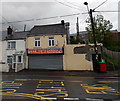
Nantyglo Village Store and Post Office
Located at 69 King Street, Nantyglo.
Image: © Jaggery
Taken: 14 Jun 2013
0.11 miles
4
Conversion of former Nantyglo Institute to housing
A notice outside the former Nantyglo Institute in New Road states that luxury maisonettes will be available to rent here from March. Presumably March 2014 is meant. Conversion work was at an early stage at the mid-June 2013 date of this view.
Image: © Jaggery
Taken: 14 Jun 2013
0.12 miles
5
Nantyglo Stores, Nantyglo
Convenience stores in King Street.
Image: © Jaggery
Taken: 14 Jun 2013
0.13 miles
6
Banna Park Bungalows, Nantyglo
A cul-de-sac connecting to Porters Road via Golf View. http://www.geograph.org.uk/photo/2281414 The bungalows face a recreation ground.
Image: © Jaggery
Taken: 3 Feb 2011
0.14 miles
7
Nantyglo RFC
Image: © andy dolman
Taken: 13 Feb 2008
0.15 miles
8
Gwent Terrace north of Ffosmaen Road, Nantyglo
Viewed from the corner of Ffosmaen Road looking north along Gwent Terrace towards Milfraen Avenue.
The former Ffosmaen Inn http://www.geograph.org.uk/photo/3516391 is on the right.
Image: © Jaggery
Taken: 14 Jun 2013
0.16 miles
9
Tasty Garden, Nantyglo
Chinese and Cantonese cuisine takeaway located at the SE end of King Street, at number 96.
Image: © Jaggery
Taken: 14 Jun 2013
0.16 miles
10
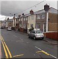
New Road houses, Nantyglo
Viewed looking north towards Brynmawr.
Image: © Jaggery
Taken: 14 Jun 2013
0.17 miles


