1
Rhymney Comprehensive School
The view from Abertysswg across the Rhymney Valley towards Pontlottyn
The school has occupied this site since 1983 and serves a number of the surrounding villages.
Image: © Robin Drayton
Taken: 23 Aug 2008
0.02 miles
2
Idris Davies School 3-18 in the Rhymney Valley
Viewed in May 2019. Pontlottyn houses are in the background. An August 2011 Google Street View shows Rhymney Comprehensive School here. Idris Davies School 3-18 opened on January 8th 2018. It is the first English-medium school in Wales offering a through school education for pupils between the ages of 3 and 18. The school was created from the amalgamation of Rhymney Comprehensive School, Abertysswg Primary School and Pontlottyn Primary School.
Image: © Jaggery
Taken: 4 May 2019
0.02 miles
3
Abertysswg Comprehensive School
My Old School.
Image: © Melanie Hartshorn
Taken: 29 Sep 2008
0.03 miles
4
Green-veined White butterfly on a Dandelion
Near to the Rhymney River at Pontlottyn.
For a detailed description see http://www.geograph.org.uk/photo/2521859.
Image: © Robin Drayton
Taken: 14 May 2014
0.07 miles
5
Footpath & cycleway towards Idris Davies School 3-18, Rhymney
Part of National Cycle Network route 468 which extends
from Bargoed to the Rhymney Valley via New Tredegar.
Image: © Jaggery
Taken: 4 May 2019
0.09 miles
6
Roadside electricity substation in Abertysswg
Western Power Distribution electricity substation alongside the road from Rhymney to Abertysswg.
Image: © Jaggery
Taken: 4 May 2019
0.12 miles
7
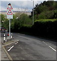
Warning signs on the approach to a school, Abertysswg
On the descent towards an entrance to Idris Davies School 3-18. Ysgol is Welsh for School.
Image: © Jaggery
Taken: 4 May 2019
0.12 miles
8
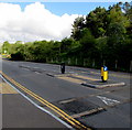
Pedestrian refuge near Abertysswg
Across the minor road to Rhymney. The Abertysswg boundary sign https://www.geograph.org.uk/photo/6144522 is out of shot nearby.
Image: © Jaggery
Taken: 4 May 2019
0.13 miles
9
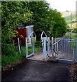
Barriers across a footpath and cycleway, Rhymney
A gate and an inwardly-sloping barrier are across this https://www.geograph.org.uk/photo/6145808 combined footpath and cycleway.
Image: © Jaggery
Taken: 4 May 2019
0.13 miles
10
The Rhymney River
Near to Pontlottyn.
Taken from a footbridge looking down river.
Image: © Robin Drayton
Taken: 14 May 2014
0.14 miles


