1
Andrew Buchan clock, Rhymney
Andrew Buchan, who was born in Scotland in 1788 and came to Rhymney when he was a young man, initially worked at local farms as a carpenter.
In 1833 he was contracted by the Bute Ironworks Company to straighten and deepen the bed of the River Rhymney.
The labourers were given notes to exchange for goods at the local company store and the shop was then paid for the goods, the money being deducted from the workers pay. This was a form of Truck shop which was illegal at that time.
In 1851 he is recorded as a Grocer Master Employing 18 Men.
From 1838 to 1858 he was the manager of the Rhymney Brewery which became the largest in Wales.
He died in 1870, well respected as a local benefactor.
The clock was originally situated at the entrance to the Rhymney Brewery.
Image: © Robin Drayton
Taken: 23 May 2012
0.00 miles
2
Rhymney College [3]
This is the rear of the building that is shown here www.geograph.org.uk/photo/1083051.
For information on the clock see www.geograph.org.uk/photo/2967466 .
Image: © Robin Drayton
Taken: 23 May 2012
0.00 miles
3
Clock on the side of Fit4Living premises, Rhymney
https://www.geograph.org.uk/photo/2967466 to a closer view and some details.
Image: © Jaggery
Taken: 11 Jul 2019
0.00 miles
4
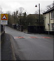
Warning sign alongside The Terrace, Rhymney
Humps for 190 yards ahead on the approach to High Street.
Image: © Jaggery
Taken: 5 Apr 2019
0.01 miles
5
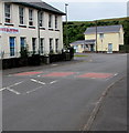
Three speeds bumps on The Terrace, Rhymney
On the approach to Rhymney railway station.
Image: © Jaggery
Taken: 11 Jul 2019
0.01 miles
6
Whitbread Centre, Rhymney
Located on the corner of The Terrace and Rhymney Walk, this part of the Whitbread Centre
houses Fit4Living fitness centre, entrance near the left edge of the view.
Inscriptions on the Rhymney Walk side show 1913 and R.I. Co. Ltd.
Image: © Jaggery
Taken: 17 Jan 2014
0.01 miles
7
Clock on Fit4Living centre, Rhymney
Image: © Robert Eva
Taken: 9 Jun 2017
0.01 miles
8
Fit4Living fitness centre in Rhymney
Occupying part of the Whitbread Centre. See http://www.geograph.org.uk/photo/3819759 for another view and some details.
Image: © Jaggery
Taken: 17 Jan 2014
0.02 miles
9
Rhymney College [2]
This building which was originally the offices of the Rhymney Iron Company is now part of Rhymney College.
Image: © Robin Drayton
Taken: 10 Dec 2008
0.02 miles
10
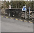
Signs alongside Surgery Hill, Rhymney
The sign on the left shows No vehicles heavier than 7.5 tonnes except for access.
The signs is the middle point towards Rhymney railway station Park & Ride and Maerdy Industrial Estate.
The small signs on the right are for National Cycle Network Route 468.
Image: © Jaggery
Taken: 12 Dec 2018
0.02 miles


![Rhymney College [3]](https://s2.geograph.org.uk/geophotos/02/96/74/2967486_39506f4b_120x120.jpg)


![Rhymney College [2]](https://s3.geograph.org.uk/geophotos/01/08/30/1083051_aa4f96c0_120x120.jpg)
