IMAGES TAKEN NEAR TO
Rowan Place, TREDEGAR, NP22 5DU

Introduction

This page details the photographs taken nearby to Rowan Place, NP22 5DU by members of the Geograph project.

The Geograph project started in 2005 with the aim of publishing, organising and preserving representative images for every square kilometre of Great Britain, Ireland and the Isle of Man.

There are currently over 7.5m images from over14,400 individuals and you can help contribute to the project by visiting https://www.geograph.org.uk

Image Map


Images are licensed for reuse under creativecommons.org/licenses/by-sa/2.0
Notes
  • Clicking on the map will re-center to the selected point.
  • The higher the marker number, the further away the image location is from the centre of the postcode.

Image Listing (129 Images Found)

Images are licensed for reuse under creativecommons.org/licenses/by-sa/2.0
  • ...
Image
Details
Distance
1
Kings Avenue, Rhymney
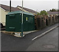
Viewed from the corner of King Edward Terrace looking east across the B4257. The large green cabinet is a Western Power Distribution electricity substation.
Image: © Jaggery Taken: 5 Apr 2019
0.03 miles
2
Upper High Street electricity substation, Rhymney
Located alongside Kings Avenue near Upper High Street, the green cabinet is a Western Power Distribution electricity substation. Its identifier is UPPER HIGH ST RHYMNEY S/S 55-2383.
Image: © Jaggery Taken: 5 Apr 2019
0.04 miles
3
Rite-Stop 1, Rhymney
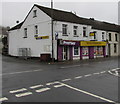
Convenience store on the corner of Church Street and Kings Avenue.
Image: © Jaggery Taken: 17 Jan 2014
0.04 miles
4
Four lock-up garages, Kings Avenue, Rhymney
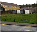
Set back from the north side of Kings Avenue viewed across the B4257.
Image: © Jaggery Taken: 5 Apr 2019
0.04 miles
5
Maxi's Meats in Rhymney
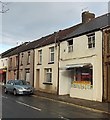
Today's special offers are displayed in the window of the Church Street butchers.
Image: © Jaggery Taken: 17 Jan 2014
0.04 miles
6
Church Street
Image: © Roger Cornfoot Taken: 9 Aug 2022
0.04 miles
7
Church Street, Rhymney [1]
Looking north.
Image: © Robin Drayton Taken: 11 Jan 2010
0.05 miles
8
Rhymney Convenience Store, Church Street, Rhymney
A Premier store on the corner of Kings Avenue viewed in April 2019. Rite-Stop 1 https://www.geograph.org.uk/photo/3816938 was here in January 2014.
Image: © Jaggery Taken: 5 Apr 2019
0.05 miles
9
Rhymney Convenience Store
Image: © Roger Cornfoot Taken: 9 Aug 2022
0.05 miles
10
Waste ground on a Rhymney corner
On the corner of Kings Avenue and the B4257 Upper High Street viewed in April 2019. The railings preventing vehicles parking here are not in a July 2016 Google Street View.
Image: © Jaggery Taken: 5 Apr 2019
0.05 miles
  • ...