IMAGES TAKEN NEAR TO
Griffiths Gardens, TREDEGAR, NP22 3HQ
Introduction
This page details the photographs taken nearby to Griffiths Gardens, NP22 3HQ by members of the Geograph project.
The Geograph project started in 2005 with the aim of publishing, organising and preserving representative images for every square kilometre of Great Britain, Ireland and the Isle of Man.

There are currently over 7.5m images from over14,400 individuals and you can help contribute to the project by visiting https://www.geograph.org.uk
Image Map
Images are licensed for reuse under creativecommons.org/licenses/by-sa/2.0
Notes
- Clicking on the map will re-center to the selected point.
- The higher the marker number, the further away the image location is from the centre of the postcode.
Image Listing (75 Images Found)
Images are licensed for reuse under creativecommons.org/licenses/by-sa/2.0
Image
Details
Distance
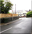
1
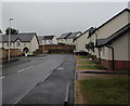
Ffordd Aneurin Bevan houses, Ashvale, Tredegar
21st century houses viewed in July 2019. The houses were being built in a May 2018 Google Street View.
Image: © Jaggery
Taken: 19 Jul 2019
0.12 miles
2
Rooftop solar panels, Brynbach Street, Ashvale, Tredegar
Viewed from The Crescent.
Image: © Jaggery
Taken: 19 Jul 2019
0.12 miles
3
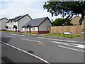
New houses, Ffordd Aneurin Bevan, Ashvale, Tredegar
Viewed in August 2019. The houses were being built in a May 2018 Google Street View.
Image: © Jaggery
Taken: 7 Aug 2019
0.13 miles
4
Welsh-only name sign, Ffordd Aneurin Bevan, Ashvale, Tredegar
Ffordd Aneurin Bevan does not have an equivalent English name.
Image: © Jaggery
Taken: 19 Jul 2019
0.14 miles
5
Dark green cabinet, The Crescent, Tredegar
Telecoms cabinet near the corner of Ashvale behind the camera.
Image: © Jaggery
Taken: 19 Jul 2019
0.14 miles
6
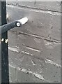
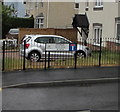
Ordnance Survey Cut Mark
This OS cut mark can be found on No49 Ashvale. It marks a point 334.483m above mean sea level.
Image: © Adrian Dust
Taken: 5 Dec 2020
0.15 miles
7
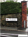
The Crescent/Y Cilgant name sign, Tredegar
English/Welsh sign on the corner of Ashvale.
Image: © Jaggery
Taken: 19 Jul 2019
0.15 miles
8
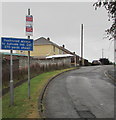
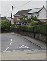
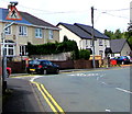
Fair View, Ashvale, Tredegar
Fair View ascends away from the road named Ashvale in the Ashvale area of Tredegar.
The white-on-blue sign shows Restricted access to Ashvale Ind(ustrial) Est(ate) 270 yards ahead.
Image: © Jaggery
Taken: 19 Jul 2019
0.15 miles
9
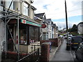
Post Office in Tredegar
One of those vital little community hubs.
Image: © Jeremy Bolwell
Taken: 13 Oct 2012
0.15 miles
10
Zebra crossing warning sign, Ashvale, Tredegar
Alongside Ashvale on the corner of Fair View on the approach to this https://www.geograph.org.uk/photo/6215168 zebra crossing.
Image: © Jaggery
Taken: 7 Aug 2019
0.15 miles