1
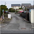
One-way street in Tafarnaubach
Ascending from Merthyr Road towards Siloam Close.
Image: © Jaggery
Taken: 15 Apr 2019
0.02 miles
2
Tafarnaubach
Viewed from a bridge over the A465 Heads of the Valleys road.
The Nags Head Inn is on the right http://www.geograph.org.uk/photo/589384 .
Image: © Robin Drayton
Taken: 5 Dec 2012
0.03 miles
3
The Nags Head, Tafarnaubach
Image: © Robin Drayton
Taken: 26 Sep 2007
0.03 miles
4
Merthyr Road bus stop and shelter near the Nags Head, Tafarnaubach
In April 2019 the shelter is alongside a stop on Harris Coaches bus route 20 to Tredegar.
The stop on the camera side is for buses to Rhymney and Rhymney railway station.
The Nags Head pub https://www.geograph.org.uk/photo/6120426 is out of shot on the right.
Image: © Jaggery
Taken: 15 Apr 2019
0.03 miles
5
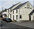
Nags Head, Merthyr Road, Tafarnaubach
Pub near the A465 Heads of the Valleys Road near Tredegar.
The road here is 375 metres (1,230 ft) above mean sea level.
Image: © Jaggery
Taken: 15 Apr 2019
0.03 miles
6
The Nags Head name sign, Tafarnaubach
Small sign over the doorway here. https://www.geograph.org.uk/photo/6120426
Image: © Jaggery
Taken: 15 Apr 2019
0.03 miles
7
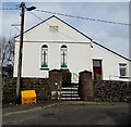
Victorian Siloam Baptist Chapel in Tafarnaubach
The Welsh tablet https://www.geograph.org.uk/photo/6120509 on the wall records that Siloam Baptist Chapel was built in 1844, rebuilt in 1877.
Image: © Jaggery
Taken: 15 Apr 2019
0.03 miles
8
Welsh tablet on Siloam Baptist Chapel, Tafarnaubach
The tablet on the wall here https://www.geograph.org.uk/photo/6120504 records that the chapel was built in 1844, rebuilt in 1877.
Image: © Jaggery
Taken: 15 Apr 2019
0.03 miles
9
Nags Head, Tafarnaubach
Merthyr Road pub near the A465 Heads of the Valleys Road near Tredegar.
The road here is 375 metres (1,230 ft) above mean sea level.
Image: © Jaggery
Taken: 15 Apr 2019
0.03 miles
10
The Nags Head, Tafarnaubach
Image: © Robin Drayton
Taken: 2 Aug 2013
0.03 miles


