1
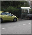
Whimsical notice on the back of a car parked alongside Brynglas Road, Newport
The yellow notice shows "IF YOU CAN READ THIS, I HAVE LOST MY CARAVAN".
Image: © Jaggery
Taken: 13 Apr 2020
0.01 miles
2
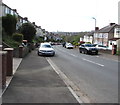
View up Brynglas Road from a postbox, Newport
Looking towards the Brynglas Avenue junction.
Image: © Jaggery
Taken: 28 Dec 2013
0.02 miles
3
Brynglas Avenue bus shelter and BT phonebox, Newport
Located near the Brynglas Avenue junction. The stop is used by buses towards the city centre. In January 2016, this route is operated by NAT (New Adventure Travel). It was previously operated by Newport Bus.
Image: © Jaggery
Taken: 5 Jan 2016
0.02 miles
4
Vehicles parked in a Brynglas Road bus stop, Newport
No buses here and elsewhere in the city today, Easter Monday April 13th 2020.
Image: © Jaggery
Taken: 13 Apr 2020
0.02 miles
5
Brynglas Road Newport phonebox - but for how much longer?
In April 2020 a BT notice dated 6/11/19 in the phonebox
states "We're thinking about removing this payphone"
Image: © Jaggery
Taken: 13 Apr 2020
0.02 miles
6
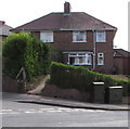
The corner of Brynglas Avenue and Brynglas Road, Newport
Image: © Jaggery
Taken: 28 Dec 2009
0.03 miles
7
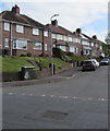
Top end of Brynglas Avenue, Newport
For most of its climb up Brynglas from Malpas Road via Redland Street, Brynglas Avenue follows a NE or NNE course. At the top of its climb, its course turns sharply to the west, to join Brynglas Road. These houses are on the north side of this top section, viewed from the corner of Brynglas Road.
Image: © Jaggery
Taken: 25 Nov 2010
0.03 miles
8
Two dark green cabinets on a Brynglas corner, Newport
Telecoms cabinets on the corner of Brynglas Avenue and Brynglas Road.
Image: © Jaggery
Taken: 13 Apr 2020
0.03 miles
9
Dark green cabinet on a Brynglas corner, Newport
Telecoms cabinet on the corner of Brynglas Avenue and Brynglas Road.
Image: © Jaggery
Taken: 13 Apr 2020
0.05 miles
10
Towards a bend in Brynglas Road, Newport
On the descent towards Malpas Road.
Image: © Jaggery
Taken: 13 Apr 2020
0.05 miles


