1
Former canal near Malpas Junction, Newport
This is the view looking in the direction of Crindau Bridge along the former Monmouthshire & Brecon canal, from Malpas (canal) Junction. A channel under the bridge connects this arm of the canal with the main branch, to Brecon via Malpas, Cwmbran and Pontypool. The former canal on the right side of the view continues behind the camera towards Crumlin via Fourteen Locks.
Image: © Jaggery
Taken: 16 Jul 2010
0.07 miles
2
Allt-yr-yn Way, Newport
Cul-de-sac on the north side of Allt-yr-yn View.
Image: © Jaggery
Taken: 17 Aug 2016
0.07 miles
3
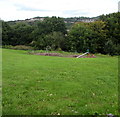
Children's playground below Barrack Hill, Newport
Located 30 metres north of Barrack Hill, at the edge of a small wood.
Image: © Jaggery
Taken: 8 Sep 2016
0.08 miles
4
Milepost at a National Cycle Network junction
This Rowe type milepost is situated beside the Monmouthshire and Brecon Canal which also has a junction at this point.
To the left is Route 47 - Town Centre 1½M, Newport Castle 1¼M.
Lower right is Route 47 - Fourteen Locks 1½M, Crosskeys 8M.
Upper right is Route 46 - Cwmbran 3¾M, Blaenafon 20M.
Image: © Robin Drayton
Taken: 27 Mar 2010
0.09 miles
5
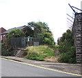
Western end of Barrack Hill, Newport
The row of houses is at the top end of Barrack Hill.
The barbed wire on the right is on top of the Raglan Barracks perimeter wall.
Image: © Jaggery
Taken: 17 Aug 2016
0.09 miles
6
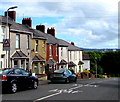
Long row of houses, Barrack Hill, Newport
Viewed across Barrack Hill from the corner of Bosworth Drive.
Image: © Jaggery
Taken: 8 Sep 2016
0.09 miles
7
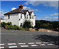
White semis, Barrack Hill,Newport
Two semi-detached houses opposite the Bosworth Drive junction. http://www.geograph.org.uk/photo/1954369
Image: © Jaggery
Taken: 8 Sep 2016
0.09 miles
8
Flat top of Barrack Hill, Newport
Viewed from the corner of Allt-yr-yn Way. At the end of a long, steep ascent (towards the camera),
the western end of Barrack Hill is flat. Barrack Hill electricity substation http://www.geograph.org.uk/photo/5108578 is on the right.
Image: © Jaggery
Taken: 8 Sep 2016
0.09 miles
9
Warning sign - Playground /Lle chwarae, Barrack Hill, Newport
The bilingual (English/Welsh) warning sign is on the approach to this http://www.geograph.org.uk/photo/5108661 playground.
Image: © Jaggery
Taken: 8 Sep 2016
0.09 miles
10
Barrack Hill electricity substation, Newport
The Western Power Distribution electricity substation is located at the top of Barrack Hill, opposite a barbed wire topped perimeter wall of Raglan Barracks. The substation identifier is BARRACK HILL S/S No 532252.
Image: © Jaggery
Taken: 8 Sep 2016
0.10 miles


