Milepost at a National Cycle Network junction
Introduction
The photograph on this page of Milepost at a National Cycle Network junction by Robin Drayton as part of the Geograph project.
The Geograph project started in 2005 with the aim of publishing, organising and preserving representative images for every square kilometre of Great Britain, Ireland and the Isle of Man.

There are currently over 7.5m images from over 14,400 individuals and you can help contribute to the project by visiting https://www.geograph.org.uk
Milepost at a National Cycle Network junction
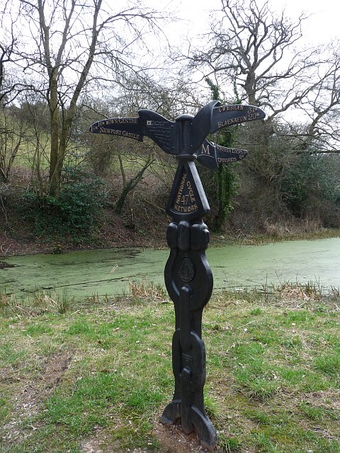
Image: © Robin Drayton Taken: 27 Mar 2010
This Rowe type milepost is situated beside the Monmouthshire and Brecon Canal which also has a junction at this point. To the left is Route 47 - Town Centre 1½M, Newport Castle 1¼M. Lower right is Route 47 - Fourteen Locks 1½M, Crosskeys 8M. Upper right is Route 46 - Cwmbran 3¾M, Blaenafon 20M.
Images are licensed for reuse under creativecommons.org/licenses/by-sa/2.0
Image Location
Latitude
51.599209
Longitude
-3.006836