IMAGES TAKEN NEAR TO
Allt-yr-Yn, NEWPORT, NP20 5EJ

Introduction

This page details the photographs taken nearby to Allt-yr-Yn, NP20 5EJ by members of the Geograph project.

The Geograph project started in 2005 with the aim of publishing, organising and preserving representative images for every square kilometre of Great Britain, Ireland and the Isle of Man.

There are currently over 7.5m images from over14,400 individuals and you can help contribute to the project by visiting https://www.geograph.org.uk

Image Map


Images are licensed for reuse under creativecommons.org/licenses/by-sa/2.0
Notes
  • Clicking on the map will re-center to the selected point.
  • The higher the marker number, the further away the image location is from the centre of the postcode.

Image Listing (20 Images Found)

Images are licensed for reuse under creativecommons.org/licenses/by-sa/2.0
Image
Details
Distance
1
Wern-ddu farm, near Newport
Image: © Ruth Sharville Taken: 1 May 2010
0.03 miles
2
Wern-ddu farm
The approach to Wern-ddu with horses and geese in a paddock. A great contrast to the busy M4 nearby.
Image: © Robin Drayton Taken: 23 Aug 2007
0.03 miles
3
Wern-ddu Farm
Seen from the bridleway. The bridleway runs as far as the farm, then becomes a footpath to Bettws. A footpath branches from the bridleway at this point and heads towards Mescoed.
Image: © Michael Dibb Taken: 10 Mar 2010
0.04 miles
4
Muddy track
The sign on the right indicates that this is a public footpath. However, OS maps show the path a few yards to the south which would avoid this mud.
Image: © Alan Hughes Taken: 26 Oct 2023
0.10 miles
5
Sleeper and chair
There must be millions of old wooden railway sleepers scattered around the country doing duty in all manner of ways. This one, serving as a gate post, is highly unusual as it still has the rail chair attached. The chair is dated 1969.
Image: © Michael Dibb Taken: 10 Mar 2010
0.11 miles
6
Bridleway and motorway
A view of the driveway to Wern-ddu Farm, which is also a bridleway. The driveway makes a right turn to pass under the M4 motorway. A motorway information gantry is visible and, to its left, the buildings of Grove Farm.
Image: © Michael Dibb Taken: 10 Mar 2010
0.16 miles
7
Half a mile to M4 junction 26 at Crindau, Newport
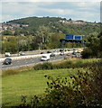
A view from the path alongside the disused Monmouthshire & Brecon Canal towards a gantry over the eastbound carriageway of the M4 motorway. One of the signs on the gantry shows ½ mile to junction 26.
Image: © Jaggery Taken: 8 Aug 2011
0.17 miles
8
Sign gantry over M4 eastbound ahead of junction 26
Image: © David Smith Taken: 4 Jun 2018
0.17 miles
9
Gantry over the M4 near Newport
Image: © Anthony Parkes Taken: 10 Mar 2016
0.18 miles
10
Gwent : The M4 Motorway
The M4 Motorway heading eastbound near Newport.
Image: © Lewis Clarke Taken: 23 Mar 2014
0.18 miles