1
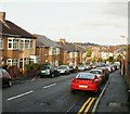
Sorrel Drive, Newport
Sorrel Drive is the principal road through Barrack Fields, a recent housing development in Allt-yr-yn. This view, of houses on the east side, is from near the Coltsfoot Close junction, looking towards the Comfrey Close junction. Behind the houses, about 30 metres away and at a higher elevation, are houses in Queen's Hill Crescent.
Image: © Jaggery
Taken: 10 Dec 2009
0.03 miles
2
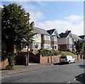
Sorrel Drive, Newport
Sorrel Drive is the principal road through Barrack Fields, a recent housing development in Allt-yr-yn. This view is from the north end of the street, adjacent to an open space http://www.geograph.org.uk/photo/1981020 and a path to Harlequin Drive.
Image: © Jaggery
Taken: 25 Jul 2010
0.03 miles
3
Queen's Hill Crescent, Newport
The view from the edge of St Mark's Crescent.
Image: © Jaggery
Taken: 10 Dec 2009
0.03 miles
4
Queen's Hill Crescent, Allt-yr-yn, Newport
Queen's Hill Crescent descends from the north side of St Mark's Crescent.
Image: © Jaggery
Taken: 17 Aug 2016
0.05 miles
5
St Mark's Crescent electricity substation, Newport
The Western Power Distribution electricity substation is inside
a wooden enclosure on the north side of St Mark's Crescent.
Image: © Jaggery
Taken: 17 Aug 2016
0.05 miles
6
Coltsfoot Close, Newport
Viewed from Sorrel Drive. Part of a recent housing development, Barrack Fields, in the Allt-yr-yn area. Behind the houses, about 30 metres away and at a higher elevation, are houses in Queen's Hill Crescent.
Image: © Jaggery
Taken: 10 Dec 2009
0.07 miles
7
Campion Close, Newport
Houses on the north side of Campion Close, viewed from Sorrel Drive. Part of a recent housing development, Barrack Fields, in the Allt-yr-yn area.
Image: © Jaggery
Taken: 10 Dec 2009
0.07 miles
8
Trees and houses, St Mark's Crescent, Newport
The north side of St Mark's Crescent, east of the Queen's Hill Crescent junction. http://www.geograph.org.uk/photo/5080444
Image: © Jaggery
Taken: 17 Aug 2016
0.08 miles
9
Woods and houses, St Mark's Crescent, Newport
These houses on the south side of St Mark's Crescent are opposite a small area of woodland.
Image: © Jaggery
Taken: 17 Aug 2016
0.08 miles
10
Ordnance Survey Cut Mark
This OS cut mark can be found on No88 Queens Hill Crescent. It marks a point 33.601m above mean sea level.
Image: © Adrian Dust
Taken: 17 Jun 2018
0.09 miles


