IMAGES TAKEN NEAR TO
Golden Mile View, NEWPORT, NP20 3QB
Introduction
This page details the photographs taken nearby to Golden Mile View, NP20 3QB by members of the Geograph project.
The Geograph project started in 2005 with the aim of publishing, organising and preserving representative images for every square kilometre of Great Britain, Ireland and the Isle of Man.

There are currently over 7.5m images from over14,400 individuals and you can help contribute to the project by visiting https://www.geograph.org.uk
Image Map
Images are licensed for reuse under creativecommons.org/licenses/by-sa/2.0
Notes
- Clicking on the map will re-center to the selected point.
- The higher the marker number, the further away the image location is from the centre of the postcode.
Image Listing (82 Images Found)
Images are licensed for reuse under creativecommons.org/licenses/by-sa/2.0
Image
Details
Distance
1
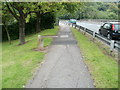
Faded former boundary marker, Bassaleg Road, Newport
An inconspicuous stone on the left edge of the pavement marks a former boundary. It shows Mon CC (Monmouthshire County Council) on the camera side, and Newport CB (County Borough) on the other side. Both sides of the marker are now within Newport City Council.
The cars are about to cross the Bassaleg Road bridge http://www.geograph.org.uk/photo/2079396 above the M4 motorway.
Image: © Jaggery
Taken: 21 Jul 2011
0.02 miles
2
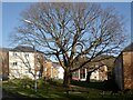
Golden Mile View, Newport
These flats are on the site of the former clubhouse for Tredegar Park Golf Club.
It relocated to a new site in 1999.
The name Golden Mile refers to a stretch of railway for which tolls were paid to Lord Tredegar.
See https://www.geograph.org.uk/photo/2302916 for details.
Image: © Robin Drayton
Taken: 22 Feb 2021
0.04 miles
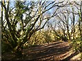
3
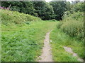
Track into woodland from Bassaleg Road, Newport
The track is reached via a kissing gate http://www.geograph.org.uk/photo/2528784 on the edge of Bassaleg Road.
Image: © Jaggery
Taken: 21 Jul 2011
0.05 miles
4
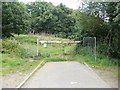
Entrance to woodland on the north side of Gaer Fort, Newport
A kissing gate on the left of locked, rusty gates, leads to a path into woodland.
Viewed from Bassaleg Road.
Image: © Jaggery
Taken: 21 Jul 2011
0.05 miles
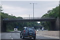
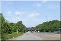
6
M4 Motorway - Bassaleg Road overbridge, Newport
Image: © J Whatley
Taken: 22 Sep 2010
0.06 miles
7
North-west corner of Gaer Fort
Just inside the entrance gate from Bassaleg Road, the lower path was extremely muddy following winter rains.
Image: © Robin Drayton
Taken: 22 Feb 2021
0.07 miles
8
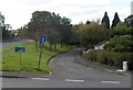
Former route of Bassaleg Road, Newport
Viewed across Western Avenue. Now a no through road ending at the edge of the M4 motorway,
this was formerly the route of Bassaleg Road, which was realigned a few metres to the left when the motorway was built in this area in the 1960s.
Image: © Jaggery
Taken: 29 Sep 2012
0.07 miles
9
M4 crossing Ebbw River
In the distance is the railway bridge over the motorway
Image: © David Smith
Taken: 4 Jun 2018
0.07 miles
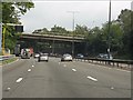
10
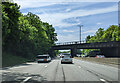
On the M4 heading south, about to go under a railway bridge
Image: © Rob Purvis
Taken: 21 May 2023
0.07 miles