Faded former boundary marker, Bassaleg Road, Newport
Introduction
The photograph on this page of Faded former boundary marker, Bassaleg Road, Newport by Jaggery as part of the Geograph project.
The Geograph project started in 2005 with the aim of publishing, organising and preserving representative images for every square kilometre of Great Britain, Ireland and the Isle of Man.

There are currently over 7.5m images from over 14,400 individuals and you can help contribute to the project by visiting https://www.geograph.org.uk
Faded former boundary marker, Bassaleg Road, Newport
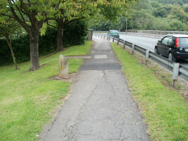
Image: © Jaggery Taken: 21 Jul 2011
An inconspicuous stone on the left edge of the pavement marks a former boundary. It shows Mon CC (Monmouthshire County Council) on the camera side, and Newport CB (County Borough) on the other side. Both sides of the marker are now within Newport City Council. The cars are about to cross the Bassaleg Road bridge http://www.geograph.org.uk/photo/2079396 above the M4 motorway.
Images are licensed for reuse under creativecommons.org/licenses/by-sa/2.0
Image Location
Latitude
51.576411
Longitude
-3.033174