1
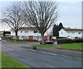
South side of Byron Road, Newport
Houses on the south side of Byron Road, between the west http://www.geograph.org.uk/photo/2171880 and east http://www.geograph.org.uk/photo/2171894 ends of Rupert Brooke Drive.
Image: © Jaggery
Taken: 22 Nov 2010
0.04 miles
2
Byron Road, Newport
The view south from Stelvio Park Drive, looking past trees at the intersection with Melfort Road, towards houses on Rupert Brooke Drive and Browning Close.
Image: © Jaggery
Taken: 22 Nov 2010
0.05 miles
3
Tree-lined corner of Melfort Road and Byron Road, Newport
Viewed across Byron Road.
Image: © Jaggery
Taken: 22 Nov 2010
0.05 miles
4
Replacing felled trees, Gaer Estate, Newport
Five Ash trees have been felled here due to disease https://www.geograph.org.uk/photo/7085369 .
This Field Maple sapling is part of the replacement program.
Image: © Robin Drayton
Taken: 10 Feb 2022
0.06 miles
5
Trees with ash die back, Gaer Estate, Newport
Newport City Council have earmarked these for removal.
They are used as a roost by 100+ jackdaws.
Image: © Robin Drayton
Taken: 31 Jan 2022
0.06 miles
6
North side of Melfort Road, Newport
Steel-framed houses viewed from near the corner of Byron Road.
Image: © Jaggery
Taken: 22 Nov 2010
0.07 miles
7
Rupert Brooke Drive, Newport
The view south from near the corner of Byron Drive. On the right are flats in Boswell Close, Buchan Close and Arnold Close.
Image: © Jaggery
Taken: 22 Nov 2010
0.08 miles
8
Browning Close, Newport
Located on the corner of Byron Road and Rupert Brooke Drive, Browning Close has one long 3-storey building, containing 18 flats.
Image: © Jaggery
Taken: 22 Nov 2010
0.08 miles
9
Gaer Estate and view over Newport (1)
The Gaer estate was one of the first estates built in Newport after the Second World War.
All of the streets are named after writers.
A Festival of Britain award was received for the design of the estate http://www.geograph.org.uk/photo/621755 .
Built in a hilly area in the west of Newport, it gives extensive views over Newport Docks and the Severn Estuary.
The City Bridge http://www.geograph.org.uk/photo/1140452 can be seen on the horizon to the left of centre, while the Transporter Bridge http://www.geograph.org.uk/photo/666383 can just be seen above the trees on the right.
See http://www.geograph.org.uk/photo/5530023 for the view to the right of this one.
Image: © Robin Drayton
Taken: 5 Sep 2017
0.10 miles
10
Footpath, Gaer Road, Newport
This is the footpath that links two parts of Gaer Road http://www.geograph.org.uk/photo/2364172.
Image: © Robin Drayton
Taken: 23 Mar 2011
0.10 miles


