1
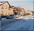
Arthur Street, Newport
The edge of Spring Gardens residential care home, on the north side of Arthur Street, viewed from Mendalgief Road.
Image: © Jaggery
Taken: 30 Nov 2009
0.03 miles
2
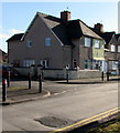
Newport : Arthur Street side of Spring Gardens care home
Spring Gardens is a residential care home owned by Newport City Council, located on the corner of Mendalgief Road and Arthur Street. It caters for 34 elderly people with dementia.
Image: © Jaggery
Taken: 24 Dec 2010
0.03 miles
3
Newport : Mendalgief Road houses between Robert Close and Arthur Street
Viewed across the corner of Mendalgief Road and Robert Close.
Image: © Jaggery
Taken: 16 Oct 2011
0.03 miles
4
Robert Place, Newport
Viewed from Mendalgief Road. The street nameplate on the low wall at the right corner shows Robert Place, which contradicts the online Ordnance Survey map, which gives Robert Close.
Image: © Jaggery
Taken: 30 Nov 2009
0.03 miles
5
Robert Place houses, Newport
Looking towards Mendalgief Road from the edge of a recreation ground. The original housing here was typical late-Victorian terraced housing. The street was originally named Robert Street and connected with Courtybella Terrace in the days before the recreation ground existed.
Image: © Jaggery
Taken: 24 Dec 2010
0.03 miles
6
Corner of Price Close and Mendalgief Road, Newport
Viewed across Mendalgief Road.
Image: © Jaggery
Taken: 12 Feb 2020
0.05 miles
7
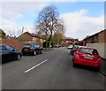
Price Close, Newport
Viewed from the corner of Mendalgief Road.
Image: © Jaggery
Taken: 29 Oct 2017
0.05 miles
8
Arthur Street, Newport
From the corner of Belle Vue Terrace, Arthur Street extends for 160 metres to Mendalgief Road.
Image: © Jaggery
Taken: 29 Oct 2017
0.05 miles
9
Demolition site, Mendalgief Road
The site was occupied for 85 years by the Whiteheads steelworks which in its heyday in the 1970s employed up to 3000 people. Recently, just before its closure in 2005 it was the Corus Special Strip (CSS) operation.
At the date of this photo it was earmarked for hospital and related uses, but this never happened.
In 2022 the preparation for the development of Royal Victoria Court, a brand-new mixed tenure development of 528 quality homes, was underway.
The trees in the background are in Belle Vue Park. http://www.geograph.org.uk/photo/705342
Image: © Robin Drayton
Taken: 27 Oct 2008
0.05 miles
10
Deciduous trees in Price Close, Newport
Viewed across Mendalgief Road in February 2020.
Image: © Jaggery
Taken: 12 Feb 2020
0.06 miles


