1
Toyota World, Newport
Toyota dealership located on the corner of Docks Way and Port Road, in the middle of an area of retail parks.
Image: © Jaggery
Taken: 19 Sep 2009
0.01 miles
2
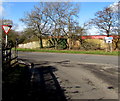
Port Road, Newport
Port Road curves away from Docks Way, heading for Maesglas Retail Park.
On the right is Toyota World.http://www.geograph.org.uk/photo/1961256
Image: © Jaggery
Taken: 19 Sep 2009
0.01 miles
3
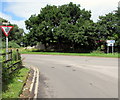
Deciduous trees in winter, Docks Way, Newport
Viewed from West Way Road in February 2020.
https://www.geograph.org.uk/photo/5234470 to a view of these trees in summer (July 2016).
Image: © Jaggery
Taken: 12 Feb 2020
0.01 miles
4
Junction of Docks Way and West Way Road
Image: © Nick Mutton 01329 000000
Taken: 29 Jun 2010
0.01 miles
5
Walls tow truck, Docks Way, Newport
Breakdown recovery vehicle approaching the West Way Road junction in February 2020.
Its number plate includes the letters TOW.
Image: © Jaggery
Taken: 12 Feb 2020
0.02 miles
6
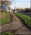
National Cycle Route 4, Docks Way, Newport
National Cycle Route 4 is a long distance route between London and Fishguard in West Wales, via Reading, Bath, Bristol, Newport, Swansea, Carmarthen, Tenby, Haverfordwest and St Davids.
Image: © Jaggery
Taken: 3 Jan 2017
0.02 miles
7
Ildiwch/Give Way sign facing West Way Road, Newport
The bilingual (Welsh/English) sign is at the Docks Way junction.
Image: © Jaggery
Taken: 11 Jul 2016
0.02 miles
8
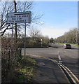
South Dock (North Side) direction sign, Docks Way, Newport
The sign points towards West Way Road. https://www.geograph.org.uk/photo/6391990 The text is also in Welsh.
Image: © Jaggery
Taken: 12 Feb 2020
0.03 miles
9
Royal Mail van, Docks Way, Newport
Parked near 28 East Retail Park.
Image: © Jaggery
Taken: 12 Feb 2020
0.03 miles
10
Port Road, Newport
From Docks Way, Port Road leads to Maesglas Retail Estate.
Image: © Jaggery
Taken: 12 Feb 2020
0.03 miles


