1
Capel Crescent flats, Newport
Flats on the NE side of Capel Crescent. The flats are numbered in the high 200s (eg 290 Capel Crescent). Unusually, the numbering sequence is used by housing built around the same time in neighbouring streets. For example, the twenty properties in nearby Kirby Lane are from 317 to 336, and the lowest number in Daniel Place is 384.
Image: © Jaggery
Taken: 15 Dec 2010
0.03 miles
2
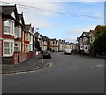
Alma Street, Newport
The southwest end of Alma Street viewed across Capel Crescent.
Image: © Jaggery
Taken: 29 Oct 2017
0.04 miles
3
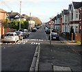
Capel Crescent, Newport
Looking southeastwards along Capel Crescent from near the Alma Street junction.
Despite its name, this part of the crescent is straight - just out of view, the far end of the crescent bends to the left on the approach to Commercial Road.
Image: © Jaggery
Taken: 30 Nov 2009
0.05 miles
4
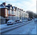
Capel Crescent houses
Houses on the south side of Capel Crescent.
Image: © Jaggery
Taken: 30 Nov 2009
0.05 miles
5
Alma Street, Newport
The view west along Alma Street, from the corner of Rutland Place. http://www.geograph.org.uk/photo/1887372
Image: © Jaggery
Taken: 30 May 2010
0.05 miles
6
Newport : Alma Street from the west
Looking along Alma Street from near the Capel Crescent end.
Image: © Jaggery
Taken: 30 May 2010
0.05 miles
7
Corner of Alma Street and Capel Crescent, Newport
Alma Street on the left heads away from Capel Crescent.
Image: © Jaggery
Taken: 24 Dec 2010
0.05 miles
8
North side of Capel Crescent, Newport
Houses on the north side of the crescent, a few tens of metres east of the Alma Street turning. http://www.geograph.org.uk/photo/2207003
Image: © Jaggery
Taken: 24 Dec 2010
0.05 miles
9
Rutland Place, Newport
Houses on the west side of Rutland Place, viewed from the Alma Street end.
In the distance is a small part of the Royal Gwent Hospital. http://www.geograph.org.uk/photo/527560
Image: © Jaggery
Taken: 30 May 2010
0.05 miles
10
Kirby Lane, Newport
Housing on the corner of Kirby Lane and Alma Street. Kirby Lane contains houses and flats. The properties are numbered between 316 and 336, part of a sequence shared with nearby streets built at about the same time.
Image: © Jaggery
Taken: 17 Dec 2010
0.05 miles


