1
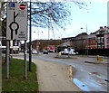
Parking area between Kingsway and Ebenezer Terrace, Newport
The sign on the right shows that from 8am-8pm Mondays-Saturdays this parking area is reserved
for holders of T1 resident permits. No parking at any time to the right of the sign.
Image: © Jaggery
Taken: 24 Jul 2016
0.01 miles
2
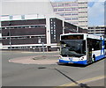
Cardiff Bus double-decker, Kingsway, Newport
On bus route 30 to Cardiff via Castleton. Service 30 is jointly operated by Newport Bus, the major provider of buses in the city of Newport and surrounding areas and Cardiff Bus, the major provider of buses in the city of Cardiff and surrounding areas.
Image: © Jaggery
Taken: 14 Sep 2018
0.02 miles
3
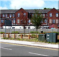
St Pauls Walk, Newport city centre
St Pauls Walk is a recently created public space between Commercial Street (on the camera side) and Kingsway viewed in mid July 2017. Ebenezer Terrace houses are in the background.
Image: © Jaggery
Taken: 19 Jul 2017
0.02 miles
4
Kingsway direction sign, Newport
Facing Kingsway traffic approaching the city centre.
Straight ahead for the 1,000 space multistorey Kingsway Centre car park.
Image: © Jaggery
Taken: 9 Feb 2016
0.02 miles
5
East through St Paul's Walk, Newport
St Paul's Walk is a public space between Commercial Street and Kingsway.
The houses are in Ebenezer Terrace on the east side of Kingsway.
Image: © Jaggery
Taken: 8 Jan 2020
0.02 miles
6
Kingsway, Newport
From the corner of Commercial Road along Kingsway into the city centre.
The Ebenezer Terrace junction is on the right.
Image: © Jaggery
Taken: 7 Jul 2017
0.02 miles
7
Telecoms cabinets, St Paul's Walk, Kingsway, Newport
Opposite Ebenezer Terrace. The backs of Commercial Street buildings are in the background.
Image: © Jaggery
Taken: 7 Jul 2017
0.02 miles
8
N1 bus in Kingsway, Newport
The NAT (New Adventure Travel) bus is on route N1 to the Duffryn area of Newport via Cardiff Road.
Image: © Jaggery
Taken: 7 Jul 2017
0.02 miles
9
King's Church, Newport
Located on Lower Dock Street.
Image: © Jaggery
Taken: 27 Nov 2009
0.03 miles
10
Gwent Mediation, Lower Dock Street
Located on the corner of Lower Dock Street and Dumfries Place. The street nameplate on the building shows simply 'Dock Street', dating back to the era before the street was split into Upper and Lower.
Services offered include family mediation for separating and divorcing couples who need to discuss future arrangements for children, finances and property. Mediation also for grandparents whose contact and/or relationship with their grandchildren is affected by divorce/separation.
Image: © Jaggery
Taken: 27 Nov 2009
0.03 miles


