1
Royal Arms of Queen Victoria on the Old Custom House
http://www.geograph.org.uk/photo/1643133
Image: © Robin Drayton
Taken: 1 Jan 2010
0.01 miles
2
The Old Custom House, Lower Dock Street
Built in 1857 and carrying the Royal Arms of Queen Victoria http://www.geograph.org.uk/photo/1643115 .
For information for the building on the right see http://www.geograph.org.uk/photo/1614309 .
Image: © Robin Drayton
Taken: 1 Jan 2010
0.01 miles
3
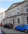
The Old Custom House, Newport
Image: © John Lord
Taken: 30 Mar 2011
0.01 miles
4
Old Custom House, Lower Dock Street, Newport
Victorian building (erected 1858) with a pediment containing a crest. The blue plaque http://www.geograph.org.uk/photo/5453308 on the building records
"As ship movements concentrated even further down river" (the Usk) "ship brokers, chandlers, consulates and bonded warehouses became established in Lower Dock Street. HM Customs moved here from Skinner Street in 1858".
The Grade II listed building is now used as offices.
Image: © Jaggery
Taken: 7 Jul 2017
0.01 miles
5
The Custom House blue plaque, Lower Dock Street, Newport
The oval blue plaque is on top of the doorway here. http://www.geograph.org.uk/photo/5453306
Image: © Jaggery
Taken: 7 Jul 2017
0.01 miles
6
Lower Dock Street towards George Street, Newport
Looking to the southeast along Lower Dock Street past the Dumfries Place junction.
Image: © Jaggery
Taken: 7 May 2020
0.02 miles
7
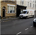
King's Church office and van, Newport
In early May 2020 a King's Church van is parked near the King's Church office at 71 Lower Dock Street.
Image: © Jaggery
Taken: 7 May 2020
0.02 miles
8
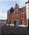
Grade II Listed 120 Lower Dock Street, Newport
The distinctive red brick building in the Northern European Renaissance style dates from c1900.
Image: © Jaggery
Taken: 7 May 2020
0.02 miles
9
Unit 4 Vehicle Repairs, Newport
Located in Granville Street.
Image: © Jaggery
Taken: 22 Jan 2013
0.02 miles
10
Hatti Indian cuisine restaurant, Newport
Hatti opened in late 2015 in Lower Dock Street premises formerly occupied by the Chandlery restaurant. http://www.geograph.org.uk/photo/1597581
The three-storey building is Grade II listed.
Image: © Jaggery
Taken: 9 Feb 2016
0.02 miles


