1
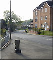
Corner of Bishpool Way and Bishpool Gardens, Newport
Looking along Bishpool Way past the turning for Bishpool Gardens. The modern bungalows replaced prefabs. http://www.geograph.org.uk/photo/1981336
Image: © Jaggery
Taken: 5 Dec 2010
0.01 miles
2
Bishpool View houses, Newport
Viewed from Bishpool Way looking across Bishpool Lane.
The area was formerly known as Vishpool or Fishpool. Fishpool was the name shown in the 1841 UK national census. In the 1851 census, the name was Bishpool. The reason for the change is unknown. Perhaps residents felt that 'Bish' with suggestions of 'bishop' was grander than a mere fish...
Image: © Jaggery
Taken: 5 Dec 2010
0.05 miles
3
Treberth Crescent, Newport
From Chepstow Road.
Image: © Jaggery
Taken: 18 Oct 2009
0.06 miles
4
Boundary Stone, Bishpool Lane, Newport
Looking along Bishpool Lane from Chepstow Road. The faded boundary stone on the left formerly marked the boundary between Monmouthshire on the left and the County Borough of Newport on the right.
Image: © Jaggery
Taken: 18 Oct 2009
0.08 miles
5
Bishpool Lane, Newport
The view north along Bishpool Lane, looking towards Chepstow Road from the corner of Bishpool Way.
Image: © Jaggery
Taken: 5 Dec 2010
0.08 miles
6
Old Boundary Marker by the B4237, Chepstow Road
Parish Boundary Marker by the B4237 (was A48), in Ringland community (Newport District), Chepstow Road, at junction with Bishpool Lane, on pavement. MON_NPT01pb is diagonally opposite on the corner of Eisteddfod Walk:
Image
Inscription reads:-
: COUNTY / MONMOUTH : : 1889 : : NEWPORT / BOROUGH :
Surveyed
Milestone Society National ID: MON_NPT01pb
Image: © M Faherty
Taken: 10 Jul 2016
0.09 miles
7
Old Boundary Marker by the B4237, Chepstow Road
Parish Boundary Marker by the B4237 (was A48), in Ringland community (Newport District), Chepstow Road, at junction with Eisteddfod Walk, on verge. MON_NPT01pb is diagonally opposite on the corner of Bishpool Lane:
Image
Inscription reads:-
: NEWPORT / BOROUGH : : 1889 : : CHRISTCHURCH / HIGHWAY / DISTRICT :
Surveyed
Milestone Society National ID: MON_NPT02pb
Image: © M Faherty
Taken: Unknown
0.10 miles
8
Modern flats, Bishpool View, Newport
Bishpool View is an area of modern flats and houses. It connects with Bishpool Lane.
Image: © Jaggery
Taken: 5 Dec 2010
0.11 miles
9
Tree-lined section of Chepstow Road, Newport
Viewed from the northwest edge of the Treberth estate.
Image: © Jaggery
Taken: 24 Jun 2010
0.12 miles
10
Esso Treberth Service Station, Newport
Located on the north side of Chepstow Road, across the road from the Treberth housing estate.
Image: © Jaggery
Taken: 18 Oct 2009
0.12 miles


