Old Boundary Marker by the B4237, Chepstow Road
Introduction
The photograph on this page of Old Boundary Marker by the B4237, Chepstow Road by M Faherty as part of the Geograph project.
The Geograph project started in 2005 with the aim of publishing, organising and preserving representative images for every square kilometre of Great Britain, Ireland and the Isle of Man.

There are currently over 7.5m images from over 14,400 individuals and you can help contribute to the project by visiting https://www.geograph.org.uk
Old Boundary Marker by the B4237, Chepstow Road
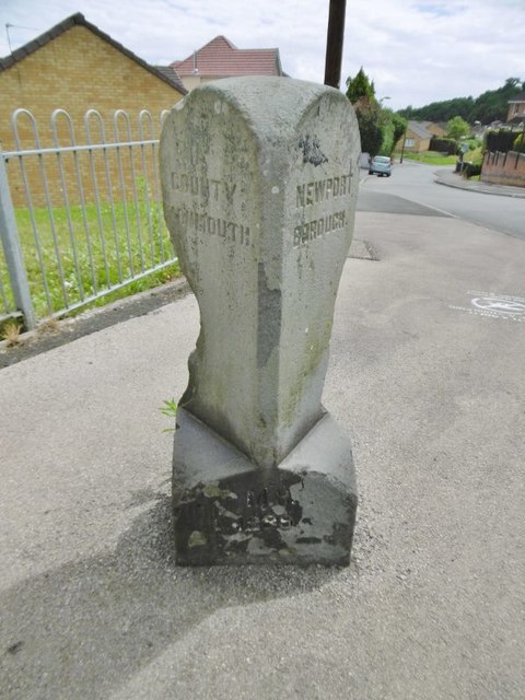
Image: © M Faherty Taken: 10 Jul 2016
Parish Boundary Marker by the B4237 (was A48), in Ringland community (Newport District), Chepstow Road, at junction with Bishpool Lane, on pavement. MON_NPT01pb is diagonally opposite on the corner of Eisteddfod Walk: Image Inscription reads:- : COUNTY / MONMOUTH : : 1889 : : NEWPORT / BOROUGH : Surveyed Milestone Society National ID: MON_NPT01pb
Images are licensed for reuse under creativecommons.org/licenses/by-sa/2.0
Image Location
Latitude
51.594648
Longitude
-2.942089