1
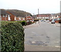
Moore Crescent, Ringland, Newport
The view south from the corner of Dawson Crescent.
Image: © Jaggery
Taken: 26 Nov 2010
0.13 miles
2
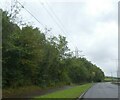
Wooded bend on Ringland Way (A48)
Image: © J Whatley
Taken: 22 Sep 2010
0.15 miles
3
Padlocked gates to abandoned Ringland Allotments, Newport
Viewed across Cot Hill, near its junction with Ringland Way. The sign shows Ringland Allotments, but the former allotment plots are now covered by grass.
Image: © Jaggery
Taken: 26 Nov 2010
0.19 miles
4
Pylon at southern edge of former Ringland Allotments, Newport
Viewed across Cot Hill near its junction with Ringland Way. Near the left edge of the view are padlocked gates http://www.geograph.org.uk/photo/2342032 at the entrance to the former Ringland Allotments.
Image: © Jaggery
Taken: 26 Nov 2010
0.19 miles
5
Ringland Way (A48) at Cot Hill junction
Image: © J Whatley
Taken: 22 Sep 2010
0.20 miles
6
A48, Southern Distributor Road, south of Coldra
Image: © David Smith
Taken: 28 Sep 2021
0.20 miles
7
Dawson Close underpass viewed from the west
Looking along Dawson Close, Ringland towards the underpass beneath Ringland Way.
A pedestrian gate is open on the right side of the underpass entrance.
The view from the other side of the underpass. http://www.geograph.org.uk/photo/1798255
Image: © Jaggery
Taken: 9 Apr 2010
0.20 miles
8
Dawson Close, Ringland, Newport
The view west from the edge of an underpass. http://www.geograph.org.uk/photo/1798257 In the distance is Hendre Farm Drive.
Image: © Jaggery
Taken: 26 Nov 2010
0.21 miles
9
A48 Ringland Way near Llanwern
Image: © Colin Pyle
Taken: 21 Sep 2015
0.22 miles
10
Cot Hill climbs towards Llanwern
Viewed from the corner of Ringland Way, Newport
Image: © Jaggery
Taken: 9 Apr 2010
0.22 miles


