1
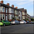
Corner of Christchurch Road and Radnor Road, Newport
The left house of the semis with the triangular frontage is on Christchurch Road ;
the one on the right is on Radnor Road.
Image: © Jaggery
Taken: 4 Mar 2010
0.01 miles
2
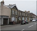
Brynderwen Road, Newport
Houses on the northern side of Brynderwen Road, viewed from the Christchurch Road end.
Image: © Jaggery
Taken: 4 Mar 2010
0.01 miles
3
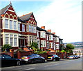
Eastern end of Brynderwen Road, Newport
Looking west along Brynderwen Road towards Christchurch Road
from the corner of Crescent Road and Victoria Avenue.
Image: © Jaggery
Taken: 10 Jun 2016
0.02 miles
4
Cars and houses on the south side of Christchurch Road, Newport
Viewed from the corner of Radnor Road.
Image: © Jaggery
Taken: 7 Aug 2018
0.04 miles
5
Later Victorian Temperance Cottages, Christchurch Road, Newport
A plaque https://www.geograph.org.uk/photo/5866134 on a cottage wall shows the year 1887.
Image: © Jaggery
Taken: 7 Aug 2018
0.04 miles
6
Houses on the south side of Christchurch Road, Newport
West of the Victoria Avenue junction.
Image: © Jaggery
Taken: 10 Jun 2016
0.04 miles
7
Temperance Cottages 1887 plaque, Christchurch Road, Newport
On the wall centre right here. https://www.geograph.org.uk/photo/5866127
1887 was Queen Victoria's Golden Jubilee year.
Image: © Jaggery
Taken: 7 Aug 2018
0.04 miles
8
Housing variety, Christchurch Road, Newport
On the south side of Christchurch Road west of the Radnor Road junction.
Image: © Jaggery
Taken: 7 Aug 2018
0.05 miles
9
Recreation area, Summerhill, Newport
Located on the edge of the St Julians and Summerhill areas of Newport, viewed from the Brecon Road side. The path on the left runs between the edge of Radnor Road allotments, and a grassed area and children's play area.
Image: © Jaggery
Taken: 25 Feb 2010
0.06 miles
10
Entrance to Radnor Road allotments, Newport
Radnor Road is behind the camera. The path along the edge of the allotments leads to Brecon Road.
Image: © Jaggery
Taken: 25 Feb 2010
0.06 miles


