IMAGES TAKEN NEAR TO
Shetland Close, NEWPORT, NP19 7TH
Introduction
This page details the photographs taken nearby to Shetland Close, NP19 7TH by members of the Geograph project.
The Geograph project started in 2005 with the aim of publishing, organising and preserving representative images for every square kilometre of Great Britain, Ireland and the Isle of Man.

There are currently over 7.5m images from over14,400 individuals and you can help contribute to the project by visiting https://www.geograph.org.uk
Image Map
Images are licensed for reuse under creativecommons.org/licenses/by-sa/2.0
Notes
- Clicking on the map will re-center to the selected point.
- The higher the marker number, the further away the image location is from the centre of the postcode.
Image Listing (94 Images Found)
Images are licensed for reuse under creativecommons.org/licenses/by-sa/2.0
Image
Details
Distance
1
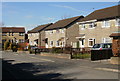
Avalon Drive, St Julians, Newport
Avalon Drive connects with Merlin Crescent and Heather Road. This view is looking towards the Heather Road end.
Image: © Jaggery
Taken: 4 Mar 2010
0.03 miles
2
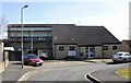
Avalon Court, St Julians, Newport
Located on Avalon Drive. Built in 1981, managed by Newport City Council.
Image: © Jaggery
Taken: 4 Mar 2010
0.03 miles
3
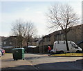
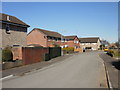
Shetland Close, St Julians, Newport
Looking towards the far end of Shetland Close. The other end of the close connects with Lundy Drive.
Image: © Jaggery
Taken: 25 Feb 2010
0.04 miles
4
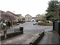
Hayling Close, St Julians, Newport
Houses on the north side of Hayling Close, viewed from the corner of Bardsy Close.
Image: © Jaggery
Taken: 4 Mar 2010
0.04 miles
5
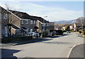
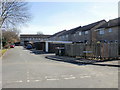
South side of Lundy Drive, St Julians, Newport
Lundy Drive descends towards St Julians Road. On the right are the turnings for
Westray Close http://www.geograph.org.uk/photo/1738307 then Bardsy Close. http://www.geograph.org.uk/photo/1738285
Image: © Jaggery
Taken: 4 Mar 2010
0.04 miles
6
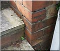
Ordnance Survey Cut Mark
This OS cut mark can be found on No96 St Julians Road. It marks a point 54.489m above mean sea level.
Image: © Adrian Dust
Taken: 9 Jun 2018
0.07 miles
7
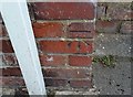
Ordnance Survey Cut Mark
This OS cut mark can be found on No97 St Julians Road. It marks a point 54.742m above mean sea level.
Image: © Adrian Dust
Taken: 9 Jun 2018
0.08 miles
8
Caldy Close, St Julians
Viewed from Heather Road.
Image: © Jaggery
Taken: 24 Sep 2009
0.08 miles
9
Ramsey Walk Close, St Julians, Newport
Houses on the south side of Ramsey Walk Close, viewed from the corner of Caldy Close.
Shown on the online Ordnance Survey map as a part of Caldy Close, but the street sign in the lower right of the photo disagrees.
Image: © Jaggery
Taken: 4 Mar 2010
0.09 miles
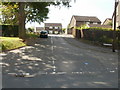
10
Westray Close, St Julians, Newport
Viewed from the corner of Lundy Drive. Streets in this area are named after British islands.
Image: © Jaggery
Taken: 4 Mar 2010
0.09 miles