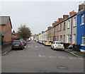
IMAGES TAKEN NEAR TO
Llanvair Mews, Llanvair Road, NEWPORT, NP19 7AD

Introduction

This page details the photographs taken nearby to Llanvair Mews, Llanvair Road, NP19 7AD by members of the Geograph project.

The Geograph project started in 2005 with the aim of publishing, organising and preserving representative images for every square kilometre of Great Britain, Ireland and the Isle of Man.

There are currently over 7.5m images from over14,400 individuals and you can help contribute to the project by visiting https://www.geograph.org.uk

Image Map


Images are licensed for reuse under creativecommons.org/licenses/by-sa/2.0
Notes
  • Clicking on the map will re-center to the selected point.
  • The higher the marker number, the further away the image location is from the centre of the postcode.

Image Listing (681 Images Found)

Images are licensed for reuse under creativecommons.org/licenses/by-sa/2.0
  • ...
Image
Details
Distance
1
Llanvair Road, Newport
Llanvair Road from Tregare Street towards Riverside. The surrounding streets are all named ... Street so it's unclear why this one is a Road.
Image: © Jaggery Taken: 19 Jan 2017
0.01 miles
2
West side of Corelli Street, Newport
Viewed from the corner of Tregare Street looking towards Riverside.
Image: © Jaggery Taken: 25 Nov 2012
0.01 miles
3
Llanvair Road, Newport
From Riverside along Llanvair Road towards Tregare Street.
Image: © Jaggery Taken: 19 Jan 2017
0.02 miles
4
Llanvair Road towards Tregare Street, Newport
Viewed from the road named Riverside on the east bank of the River Usk in July 2020.
Image: © Jaggery Taken: 13 Jul 2020
0.02 miles
5
Three telecoms cabinets, Clayton Street, Newport
Near the corner of Corelli Street.
Image: © Jaggery Taken: 19 Jan 2017
0.03 miles
6
Caldicot and Wentlooge Levels IDB van in Newport
The van is parked in Clayton Street near the corner of Corelli Street. The Caldicot and Wentlooge Levels IDB (Internal Drainage Board) offices are at Pye Corner, Broadstreet Common in the Nash area of Newport. The Board is responsible for the water level management of the Gwent Levels, a low-lying flat area between Chepstow and Cardiff, bounded by the tidal Severn Estuary to the south and the M4 motorway to the north, where valuable agricultural, commercial and residential land would otherwise be regularly flooded.
Image: © Jaggery Taken: 2 Feb 2015
0.03 miles
7
Riverside , Newport
Viewed from the Corelli Street end. On the right beyond the wall is the river Usk.
Image: © Jaggery Taken: 13 Aug 2009
0.03 miles
8
Collier Street , Newport
Viewed from the junction with Corelli Street.
Image: © Jaggery Taken: 13 Aug 2009
0.03 miles
9
Corelli Street, Newport
Looking from Collier Street towards the river wall on Riverside.
Image: © Jaggery Taken: 13 Aug 2009
0.03 miles
10
Northeast part of Riverside, Newport
Houses alongside the River Usk, viewed from the junction with Corelli Street.
Image: © Jaggery Taken: 30 Aug 2009
0.03 miles
  • ...