1
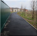
Western Park, Glan Llyn, Newport
For a plan of Glan Llyn see https://www.geograph.org.uk/photo/2794612 .
Image: © Robin Drayton
Taken: 5 May 2022
0.04 miles
2
Swans, Western Park, Glan Llyn, Newport
A swan nesting on an island with an aggressive, protective mate.
Image: © Robin Drayton
Taken: 5 May 2022
0.09 miles
3
Path towards Bridling Crescent, Newport
From the north side of the A4810 Queen's Way.
Image: © Jaggery
Taken: 27 Mar 2018
0.13 miles
4
Parklands, Glan Llyn, Newport
Parklands at Glan Llyn is a Charles Church housing development on land formerly part of Llanwern Steelworks.
Image: © Jaggery
Taken: 7 Feb 2012
0.16 miles
5
Queen's Way electricity substations, Newport
The Western Power Distribution electricity substations are alongside the A4810 Queen's Way on the SE side of the Glan Llyn housing development. The Generous George Llanwern Bull https://www.geograph.org.uk/photo/5719296 is in the background.
Image: © Jaggery
Taken: 27 Mar 2018
0.17 miles
6
Drainage channel, Glan Llyn, Newport
Formerly part of Llanwern steelworks, this area is being converted to residential use.
Viewed in February 2012.
Image: © Jaggery
Taken: 8 Feb 2012
0.18 miles
7
Greenacres and Parklands, Newport
Viewed from the edge of an A4810 roundabout in early January 2013. Houses are being built, or have recently been built, on land formerly part of Llanwern Steelworks. The board on the left is for the Persimmon Greenacres development. A Charles Church board on the right shows Parklands.
Image: © Jaggery
Taken: 8 Jan 2013
0.19 miles
8
Llanwern Steel Works, Newport
As seen from Newport Transporter Bridge in 1996.
Much of these works was demolished in 2004 following the closure in 2001 of steel making on this site.
Image: © Robin Drayton
Taken: Unknown
0.19 miles
9
Rooftop solar panels on the Llanwern Bull, Newport
A Generous George pub & restaurant alongside the A4810 Queen's Way.
Image: © Jaggery
Taken: 27 Mar 2018
0.20 miles
10
The Llanwern Bull, Queen's Way, Newport
A Generous George pub & restaurant set back from the A4810 Queen's Way.
Image: © Jaggery
Taken: 27 Mar 2018
0.20 miles


