1
Reen is the boundary between two housing estates, Newport
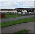
The view WSW along Liswerry Pill Reen, a drainage channel. On the left are Broadmead Park houses, on the right, Moorland Park houses. The reen is the boundary for the whole of the c450 metre length of the two estates.
Image: © Jaggery
Taken: 10 Aug 2011
0.01 miles
2
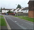
Houses in Broadmead Park, Newport
Viewed from the edge of a path from the A48 Southern Distributor Road.
Image: © Jaggery
Taken: 5 Jul 2016
0.04 miles
3
Broadmead Park houses, Newport
Viewed from the edge of a path to the A48 Southern Distributor Road.
Image: © Jaggery
Taken: 5 Jul 2016
0.06 miles
4
Houses in the NE corner of Moorland Park, Newport
Viewed over the top of a fence, from the perimeter road. I assume the fence is there to prevent children playing on the grassy area from running into the roadway.
Moorland Park is an estate of 205 houses built in the 1960s.
Image: © Jaggery
Taken: 10 Aug 2011
0.06 miles
5
Newport : Moorland Park houses viewed from the railway perimeter fence
Moorland Park is an estate of 205 houses built in the 1960s. The several arms or spurs of houses are not separately named. Addresses are from 1 to 205 Moorland Park. This arm is near the NE corner of the estate viewed from the perimeter fence of the South Wales main railway line.
Image: © Jaggery
Taken: 10 Aug 2011
0.06 miles
6
Broadmead Park houses, Newport
Houses at the SE edge of Broadmead Park, viewed from a footbridge http://www.geograph.org.uk/photo/2011307 across Spytty Road.
Image: © Jaggery
Taken: 14 Aug 2010
0.06 miles
7
Broadmead Park, Newport
Broadmead Park is an area of about 250 houses located between Moorland Park and Spytty Road.
The several roads branching from the central road are not separately named. This branch leads to houses numbered in the 130 to 190 range.
Image: © Jaggery
Taken: 5 Oct 2010
0.06 miles
8
East side of Broadmead Park, Newport
These Broadmead Park houses are near the A48.
Image: © Jaggery
Taken: 5 Jul 2016
0.06 miles
9
Moorland Park houses, Newport
The SE edge of Moorland Park, an estate of 205 houses built in the 1960s, on the west side of Spytty Road (A48). The railings are where the road crosses over Liswerry Pill Reen, a drainage channel marking the border between Moorland Park and Broadmead Park, from where this view was taken.
Image: © Jaggery
Taken: 5 Dec 2010
0.08 miles
10
East side of Broadmead Park, Newport
Viewed from the perimeter road on the east side of a 1960s housing estate containing 236 houses. There are no individually-named streets here : the house addresses are 1-236 Broadmead Park. Number 1 is in the SW corner of the estate and number 236 is in the NE corner.
To the north of Broadmead Park is Moorland Park, a housing estate built at the same time. A drainage channel, Liswerry Pill Reen, http://www.geograph.org.uk/photo/2547813 is the dividing line between the two estates.
Image: © Jaggery
Taken: 10 Aug 2011
0.08 miles


