1
View from a Bristol-Cardiff train - East Usk freight yard
Image: © Nigel Thompson
Taken: 14 Aug 2015
0.06 miles
2
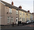
Windsor Club, Conway Road, Newport
154-156 Conway Road, opposite Windsor Road. An inscription on the wall of the club reads 'Windsor Club 1922'
Image: © Jaggery
Taken: 28 Oct 2009
0.07 miles
3
Ludlow Close, Newport
Viewed from Lilburne Drive.
Image: © Jaggery
Taken: 28 Jan 2010
0.08 miles
4
Fleetwood Close, Newport
Fleetwood Close connects with the far end of Lilburne Drive, between Ludlow Drive and the South Wales-London main railway line. The two parts of Fleetwood Close are at right angles to each other. This view is of houses on the west side of the close as it heads towards trees at the southern edge of the railway.
Image: © Jaggery
Taken: 28 Jan 2010
0.09 miles
5
Somerton track maintenance, Newport
Looking in the direction of Newport Station along the London - South Wales main line from Somerton Road bridge. The yellow vehicle is used for track maintenance.
A pair of small metal railway wheels are visible in front of the tyred wheels.
Image: © Jaggery
Taken: 24 Jan 2010
0.11 miles
6
Walmer Road, Newport
Walmer Road extends from Chepstow Road on this side to Conway Road nearly 200 metres ahead.
Image: © Jaggery
Taken: 23 Dec 2015
0.11 miles
7
Redvers Street modern housing, Newport
Housing at the far end of Redvers Street.
Image: © Jaggery
Taken: 28 Jan 2010
0.11 miles
8
Conway Road houses east of Carisbrooke Road, Newport
Houses on the north side of Conway Road viewed from the Carisbrooke Road junction.
Image: © Jaggery
Taken: 5 Jan 2013
0.11 miles
9
Carisbrooke Road, Newport
Carisbrooke Road extends from Chepstow Road on this side to Conway Road about 170 metres ahead.
Image: © Jaggery
Taken: 23 Dec 2015
0.11 miles
10
Carisbrooke Road, Newport
The view from Conway Road towards Chepstow Road.
Image: © Jaggery
Taken: 28 Oct 2009
0.11 miles


