1
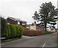
Home Farm Green, Caerleon
Houses on north side of Home Farm Green, viewed from opposite the turning for Oakdale Close.
Image: © Jaggery
Taken: 13 Mar 2010
0.06 miles
2
Steps at end of footpath, Home Farm, Caerleon
Steps lead up to Lodge Road at the end of a path that has skirted the eastern edge
of Home Farm Crescent, Home Farm Close and Home Farm Gardens.
Image: © Jaggery
Taken: 14 Mar 2010
0.06 miles
3
Track to Home Farm Green, Caerleon
Viewed from the edge of Eleanor Hodson House. A track crosses a 120-metre long field towards houses in Home Farm Green.
Image: © Jaggery
Taken: 14 Apr 2011
0.06 miles
4
Greens and brown, Home Farm Green, Caerleon
Green bushes, a brown hedge, a green hedge and an evergreen tree viewed on December 31st 2018.
Image: © Jaggery
Taken: 31 Dec 2018
0.06 miles
5
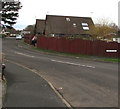
Home Farm Green, Caerleon
Cul-de-sac viewed from Roman Reach.
Image: © Jaggery
Taken: 31 Dec 2018
0.06 miles
6
Cycle route direction sign in Caerleon 3 miles from Newport city centre
The sign alongside Lodge Road points left towards Roman Reach. (88) on the sign indicates that the route leads to National Cycle Network Route 88 but is not part of it. National Cycle Network Route 88 is a proposed mainly coastal route from Newport to Margam Country Park via Cardiff and Bridgend. In 2018, the route is incomplete.
Image: © Jaggery
Taken: 31 Dec 2018
0.06 miles
7
Cycle route 88 sign on a Roman Reach lamppost, Caerleon
(88) on the sign indicates that this route leads to National Cycle Network Route 88 but is not part of it. National Cycle Network Route 88 is a proposed mainly coastal route from Newport to Margam Country Park via Cardiff and Bridgend. In 2018, the route is incomplete.
Image: © Jaggery
Taken: 31 Dec 2018
0.07 miles
8
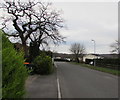
Green bushes and bare trees, Roman Reach, Caerleon
Viewed on December 31st 2018.
Image: © Jaggery
Taken: 31 Dec 2018
0.07 miles
9
Oakdale Close, Caerleon
Viewed from the corner of Home Farm Green.
Image: © Jaggery
Taken: 13 Mar 2010
0.07 miles
10
Augustan Close, Caerleon
Augustan Close is one of several suburban roads on the west side of Lodge Hill.
Seen here are a few of the 22 houses in the close, built in the late 1960s.
Image: © Jaggery
Taken: 5 Apr 2010
0.07 miles


