Cycle route direction sign in Caerleon 3 miles from Newport city centre
Introduction
The photograph on this page of Cycle route direction sign in Caerleon 3 miles from Newport city centre by Jaggery as part of the Geograph project.
The Geograph project started in 2005 with the aim of publishing, organising and preserving representative images for every square kilometre of Great Britain, Ireland and the Isle of Man.

There are currently over 7.5m images from over 14,400 individuals and you can help contribute to the project by visiting https://www.geograph.org.uk
Cycle route direction sign in Caerleon 3 miles from Newport city centre
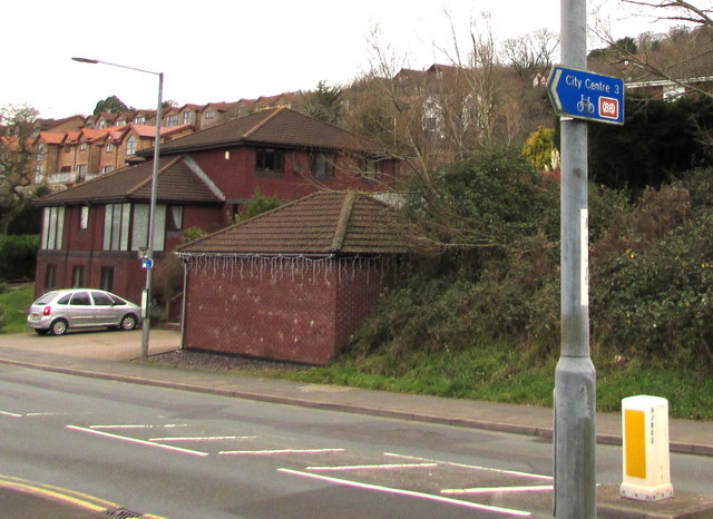
Image: © Jaggery Taken: 31 Dec 2018
The sign alongside Lodge Road points left towards Roman Reach. (88) on the sign indicates that the route leads to National Cycle Network Route 88 but is not part of it. National Cycle Network Route 88 is a proposed mainly coastal route from Newport to Margam Country Park via Cardiff and Bridgend. In 2018, the route is incomplete.
Images are licensed for reuse under creativecommons.org/licenses/by-sa/2.0
Image Location
Latitude
51.613145
Longitude
-2.974938