IMAGES TAKEN NEAR TO
Hartridge Farm Road, NEWPORT, NP18 2YE
Introduction
This page details the photographs taken nearby to Hartridge Farm Road, NP18 2YE by members of the Geograph project.
The Geograph project started in 2005 with the aim of publishing, organising and preserving representative images for every square kilometre of Great Britain, Ireland and the Isle of Man.

There are currently over 7.5m images from over14,400 individuals and you can help contribute to the project by visiting https://www.geograph.org.uk
Image Map
Images are licensed for reuse under creativecommons.org/licenses/by-sa/2.0
Notes
- Clicking on the map will re-center to the selected point.
- The higher the marker number, the further away the image location is from the centre of the postcode.
Image Listing (27 Images Found)
Images are licensed for reuse under creativecommons.org/licenses/by-sa/2.0
Image
Details
Distance
1
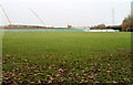
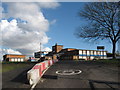
Hartridge High School playing fields
Located on the south side of the school. In the distance are two crane jibs. A major redevelopment is being undertaken at the school. http://www.geograph.org.uk/photo/2176611
Image: © Jaggery
Taken: 26 Nov 2010
0.02 miles
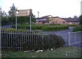
5
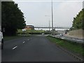
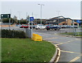
Entrance to Lower School Hartridge High
Image: © Gareth James
Taken: 12 Feb 2011
0.14 miles
6
Ysgol Gymraeg Casnewydd
A primary school, on the eastern edge of Newport.
Image: © Roger Cornfoot
Taken: 3 May 2007
0.15 miles
8
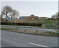
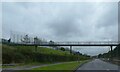
Hartridge High School, Newport
Viewed across Ringland Way. The school occupies a site on the east side of Hartridge Farm Road.
Image: © Jaggery
Taken: 26 Nov 2010
0.15 miles
9
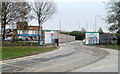
Former entrance to Hartridge High School, Newport
A major redevelopment of the school buildings at Hartridge High School http://www.geograph.org.uk/photo/2176609 is being undertaken by Leadbitter. The former school entrance is now their construction site entrance. The new school entrance is a few metres away. http://www.geograph.org.uk/photo/2176615
Image: © Jaggery
Taken: 26 Nov 2010
0.15 miles
10
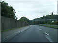
Entrance to Ysgol Gymraeg Casnewydd, Newport
The school http://www.geograph.org.uk/photo/2176598 is located on Hartridge Farm Road, alongside Hartridge High School.
Image: © Jaggery
Taken: 26 Nov 2010
0.18 miles