1
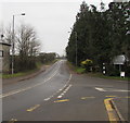
Junction in Llanmartin
On the right, Waltwood Road towards Underwood diverges from the B4245 Magor Road.
Image: © Jaggery
Taken: 14 Jan 2018
0.02 miles
2
A bend in Magor Road, Llanmartin
The B4245 Magor Road bends past Oakdale Cottage. The cars are near the right turn for Underwood.
Image: © Jaggery
Taken: 22 May 2013
0.02 miles
3
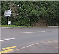
Underwood direction signs in Llanmartin
Located here, https://www.geograph.org.uk/photo/5655277 the signs at the northern end of Waltwood Road face Magor Road.
Right for Underwood, Leisure Centre, Baptist Church.
Image: © Jaggery
Taken: 14 Jan 2018
0.02 miles
4
Road junction at Llanmartin
Image: © Ruth Sharville
Taken: 19 Apr 2007
0.02 miles
5
The Old Smithy, Llanmartin
The Waltwood Road side of the former smithy on the corner of Magor Road.
Image: © Jaggery
Taken: 14 Jan 2018
0.03 miles
6
The Old Rectory, Llanmartin
A sign near the camera at the entrance drive from Waltwood Road shows
Celtic Guest Houses - The Old Rectory - 5 Star Luxury Guest House.
Image: © Jaggery
Taken: 14 Jan 2018
0.04 miles
7
Former Methodist burial ground in Llanmartin
Viewed in January 2018. The small burial ground above Magor Road is part of the site of Bethel Methodist Chapel which was demolished in the 1990s. The weathered appearance of the gravestones suggest that the last burial here was many years ago.
Image: © Jaggery
Taken: 14 Jan 2018
0.05 miles
8
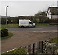
Openreach van, Waltwood Road, Llanmartin
Viewed from St Martin's churchyard in January 2018. In November 2016 Ofcom ordered BT to separate from its Openreach division, with Openreach becoming a distinct company within the BT group. In March 2017, BT Group agreed to make Openreach a separate company, with its own staff and management.
Image: © Jaggery
Taken: 14 Jan 2018
0.05 miles
9
Information board on the west side of the village church, Llanmartin
Near the Waltwood Road entrance to the Church of St Martin. https://www.geograph.org.uk/photo/5655392
Image: © Jaggery
Taken: 14 Jan 2018
0.05 miles
10
Queen Elizabeth II postbox, Waltwood Road, Llanmartin
Near a church information board. https://www.geograph.org.uk/photo/5655415
Image: © Jaggery
Taken: 14 Jan 2018
0.05 miles


