1
The Wye Valley Hotel, Tintern
A splendid 1930's roadside inn.
Image: © Jonathan Billinger
Taken: 28 Dec 2006
0.00 miles
2
Tintern - milestone by the Wye Valley Hotel
It reads : "Monmouth 10 Miles". See also :
Image
Image: © Roy Parkhouse
Taken: 23 Sep 2008
0.00 miles
3
Tintern - the Catbrook road junction
The Wye Valley Hotel is partly visible on the corner
Image: © Roy Parkhouse
Taken: 14 Jul 2007
0.01 miles
4
Wye Valley Hotel, Tintern
Located on the corner of the A466 and Trelleck Road, the hotel, restaurant and bar faces the River Wye. The hotel traces its origins to 1835 when part of the current building was known as The Carpenters Arms Public House. In 1909, the hotel was renamed and extended to its current form.
Image: © Jaggery
Taken: 27 Nov 2011
0.01 miles
5
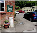
White milestone in Tintern showing Monmouth 10 (miles)
On the right here https://www.geograph.org.uk/photo/5317484 the old milestone faces the A466 at a corner of the Wye Valley Hotel.
Image: © Jaggery
Taken: 29 Jun 2019
0.01 miles
6
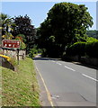
Parva Farmhouse, Tintern
Viewed across the A466, the main road through Tintern. The name sign shows
PARVA FARMHOUSE - RESTAURANT - BED & BREAKFAST.
Image: © Jaggery
Taken: 29 Jun 2019
0.01 miles
7
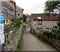
Side road descending towards the River Wye, Tintern
From the A466 the side road descends towards the north bank of the River Wye.
This way to St Michael's Church, http://www.geograph.org.uk/photo/5317403 the Wye Valley Walk and the Tewdrig Trail.
Image: © Jaggery
Taken: 17 Mar 2017
0.01 miles
8
Old Milestone by the A466, Main Road, Tintern
By the A466, in parish of Tintern (Monmouthshire District), Wye Valley Hotel, against hotel wall.
Inscription reads:- : MONMOUTH / 10 :
Surveyed
Milestone Society National ID: MON_CWMM06.
Image: © Milestone Society
Taken: Unknown
0.01 miles
9
Wye Valley Hotel, Tintern
Image: © Alan Hughes
Taken: 20 Sep 2021
0.02 miles
10
Old Station direction and distance sign, Tintern
Alongside the A466 half-a-mile from the former Tintern railway station
site which now has a cafe, picnic area, children's play area and zip wire.
Image: © Jaggery
Taken: 29 Jun 2019
0.02 miles


