IMAGES TAKEN NEAR TO
Willow Close, CHEPSTOW, NP16 5RA
Introduction
This page details the photographs taken nearby to Willow Close, NP16 5RA by members of the Geograph project.
The Geograph project started in 2005 with the aim of publishing, organising and preserving representative images for every square kilometre of Great Britain, Ireland and the Isle of Man.

There are currently over 7.5m images from over14,400 individuals and you can help contribute to the project by visiting https://www.geograph.org.uk
Image Map
Images are licensed for reuse under creativecommons.org/licenses/by-sa/2.0
Notes
- Clicking on the map will re-center to the selected point.
- The higher the marker number, the further away the image location is from the centre of the postcode.
Image Listing (69 Images Found)
Images are licensed for reuse under creativecommons.org/licenses/by-sa/2.0
Image
Details
Distance
1
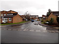
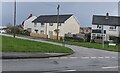
Willow Close, Bulwark, Chepstow
Viewed across Maple Avenue.
Image: © Jaggery
Taken: 15 Dec 2013
0.01 miles
2
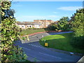
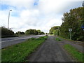
Maple Avenue from A466 bridge over the Mathern Road, Chepstow
Image: © Ruth Sharville
Taken: 11 Sep 2010
0.03 miles
3
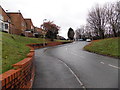
Northern end of Maple Avenue, Bulwark, Chepstow
Viewed from the corner of Mathern Road.
Image: © Jaggery
Taken: 15 Dec 2013
0.04 miles
4
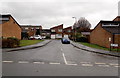
Ash Close, Bulwark, Chepstow
Viewed across Maple Avenue.
Image: © Jaggery
Taken: 15 Dec 2013
0.04 miles
6
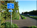
National Cycle Route 4, Chepstow
Beside the A466.
Image: © JThomas
Taken: 15 Oct 2019
0.05 miles
7
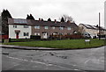
Channel View houses, Chepstow
Viewed across Mathern Road.
Image: © Jaggery
Taken: 15 Dec 2013
0.06 miles
8
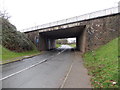
A466 bridge over Mathern Road, Chepstow
Mathern Road passes under the bridge carrying the A466 Wye Valley Link Road.
Image: © Jaggery
Taken: 15 Dec 2013
0.07 miles
9
Junction of Mathern Road and Channel View, Chepstow
Viewed across Mathern Road. The bilingual sign on the right
shows that Channel View is Golwg y Culfor in Welsh.
Image: © Jaggery
Taken: 15 Jan 2023
0.07 miles
10
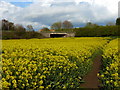
Oil-seed rape field, and A466 bridge, near Chepstow
The bridge takes the Link Road from the M48 to the A48 to Chepstow over Mathern Road.
Image: © Ruth Sharville
Taken: 22 Apr 2012
0.07 miles