1
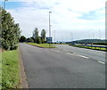
Give Way, A40, Raglan
At the NE edge of Raglan, Monmouth Road reaches the A40. Turn left for Abergavenny, right for Monmouth, Newport (via the A449), or Mitchel Troy via Groesonen Road.
Image: © Jaggery
Taken: 26 Sep 2010
0.02 miles
2
Monmouth Road houses, Raglan
Houses on the north side of the road, east of the Castle Road junction. There are no houses on the south side of the road here - it is all fields, with hedged borders.
Image: © Jaggery
Taken: 26 Sep 2010
0.02 miles
3
NE edge of Raglan
The slip road from the A40 connects with Monmouth Road at the Raglan boundary.
Image: © Jaggery
Taken: 26 Sep 2010
0.08 miles
4
Monmouth Road bus stop, Raglan
This is the last (or first) bus stop at the NE edge of Raglan, on the Monmouth route.
Image: © Jaggery
Taken: 26 Sep 2010
0.08 miles
5
A40 leaving Raglan
The A40 heads away from the NE corner of Raglan. The junction on the left is the old road to Monmouth, here named Groesonen Road. http://www.geograph.org.uk/photo/2086602
Image: © Jaggery
Taken: 26 Sep 2010
0.10 miles
6
Groesonen Road branches away from the A40
On the left is the old road to Monmouth, here named Groesonen Road, which was the A40 before the construction of the modern dual-carriageway A40.
Image: © Jaggery
Taken: 26 Sep 2010
0.10 miles
7
Slip road from A40 to Monmouth Road, Raglan
Viewed from the central reservation of the A40, looking towards the slip road on the left leading to the NE edge of Raglan.
Image: © Jaggery
Taken: 26 Sep 2010
0.10 miles
8
Abergavenny thataway, A40, Raglan
The view from the central reservation along the westbound carriageway of the A40, at the junction http://www.geograph.org.uk/photo/2086553 with Monmouth Road, at the NE edge of Raglan.
Image: © Jaggery
Taken: 26 Sep 2010
0.11 miles
9
East along the A40, Raglan
The A40 here is a bypass through the northern edge of Raglan.
Image: © Jaggery
Taken: 2 Feb 2014
0.12 miles
10
Castle Road, Raglan
Viewed across Monmouth Road. The speed limit for about 300 metres since the Raglan boundary http://www.geograph.org.uk/photo/2086619 has been 40mph, but now it's 30mph as you head towards central Raglan.
Image: © Jaggery
Taken: 26 Sep 2010
0.13 miles


