IMAGES TAKEN NEAR TO
Goytre, USK, NP15 1QP
Introduction
This page details the photographs taken nearby to NP15 1QP by members of the Geograph project.
The Geograph project started in 2005 with the aim of publishing, organising and preserving representative images for every square kilometre of Great Britain, Ireland and the Isle of Man.

There are currently over 7.5m images from over14,400 individuals and you can help contribute to the project by visiting https://www.geograph.org.uk
Image Map
Images are licensed for reuse under creativecommons.org/licenses/by-sa/2.0
Notes
- Clicking on the map will re-center to the selected point.
- The higher the marker number, the further away the image location is from the centre of the postcode.
Image Listing (13 Images Found)
Images are licensed for reuse under creativecommons.org/licenses/by-sa/2.0
Image
Details
Distance
1
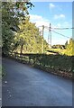
West along Plough Road, Penpedairheol, Monmouthshire
This way for Goytre.
Image: © Jaggery
Taken: 3 Oct 2021
0.04 miles
2
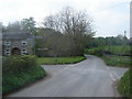
House at Penpedairheol crossroads
Seen from a field entry on Cefn Mawr Lane.
Image: © Christine Johnstone
Taken: 13 Sep 2013
0.05 miles
3
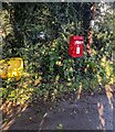
Queen Elizabeth II postbox, Rumble Street, Penpedairheol, Monmouthshire
Near the northern end of Rumble Street on the approach to crossroads.
Image: © Jaggery
Taken: 3 Oct 2021
0.06 miles
5
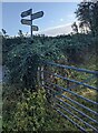
Signpost at crossroads in Penpedairheol, Monmouthshire
Opposite the junctions of Rumble Street, Plough Road, Llan Lane and Cefn Mawr Lane. Destinations shown are Goytre, Chainbridge, Monkswood, Usk.
Image: © Jaggery
Taken: 3 Oct 2021
0.07 miles
6
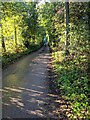
Narrow Rumble Street, Penpedairheol, Monmouthshire
Looking south along Rumble Street towards Monkswood.
Image: © Jaggery
Taken: 3 Oct 2021
0.07 miles
7
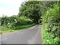
Cefn Mawr Lane, going to Penpedairheol crossroads
The triangular crossroads warning sign is almost buried in the left-hand [south side] hedge.
Image: © Christine Johnstone
Taken: 13 Sep 2013
0.09 miles
8
Llan Lane, Penpedairheol, Monmouthshire
Ahead for Chainbridge. Behind the camera for Monkswood.
Image: © Jaggery
Taken: 3 Oct 2021
0.09 miles
9
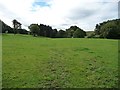
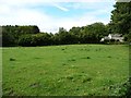
Between Cefn Mawr Lane and Rumble Street
Farmland north of Cefn Mawr, near Penpedairheol.
Image: © Christine Johnstone
Taken: 13 Sep 2013
0.10 miles
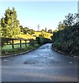
10
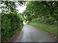
Cefn Mawr Lane, near Penpedairheol
Heading south-east towards the A472 and Usk.
Image: © Christine Johnstone
Taken: 13 Sep 2013
0.11 miles