IMAGES TAKEN NEAR TO
New Market Street, USK, NP15 1AT

Introduction

This page details the photographs taken nearby to New Market Street, NP15 1AT by members of the Geograph project.

The Geograph project started in 2005 with the aim of publishing, organising and preserving representative images for every square kilometre of Great Britain, Ireland and the Isle of Man.

There are currently over 7.5m images from over14,400 individuals and you can help contribute to the project by visiting https://www.geograph.org.uk

Image Map


Images are licensed for reuse under creativecommons.org/licenses/by-sa/2.0
Notes
  • Clicking on the map will re-center to the selected point.
  • The higher the marker number, the further away the image location is from the centre of the postcode.

Image Listing (784 Images Found)

Images are licensed for reuse under creativecommons.org/licenses/by-sa/2.0
  • ...
Image
Details
Distance
1
New Market Street, Usk
Image: © Roger Cornfoot Taken: 27 Dec 2011
0.00 miles
2
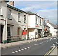
New Market Street, Usk
Viewed across the A472 Bridge Street. Burlesque Hair Company is on the left.
Image: © Jaggery Taken: 30 Aug 2015
0.00 miles
3
We Say No notice in a New Market Street house window, Usk
Viewed in August 2020. This is one of many dozens (perhaps hundreds) of notices throughout Usk objecting to the recently-introduced alternating one-way traffic system https://www.geograph.org.uk/photo/6570918 on the A472 Bridge Street in the centre of Usk. I didn't see any We Say Yes notices.
Image: © Jaggery Taken: 16 Aug 2020
0.01 miles
4
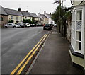
No parking in New Market Street, Usk
Double yellow lines on both sides of the street indicate no parking at any time.
Image: © Jaggery Taken: 16 Aug 2020
0.01 miles
5
Blue plaque recording site of a Usk Japanning Works
The blue plaque is on the wall http://www.geograph.org.uk/photo/5235147 of an ironmongers' yard in New Market Street. Japanning is a process which applies a brilliant hard lacquer to metal. It is most often associated with the nearby town of Pontypool. http://www.geograph.org.uk/photo/2437333
Image: © Jaggery Taken: 22 May 2011
0.01 miles
6
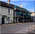
New Market Street house scaffolding, Usk
Viewed in late March 2018.
Image: © Jaggery Taken: 25 Mar 2018
0.01 miles
7
New Market Street, Usk
Taken from a point near the Old Surgery.
Image: © Pauline E Taken: 2 Aug 2009
0.01 miles
8
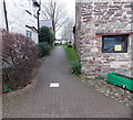
Tile marking the site of a corner of a Roman Legionary Fort in Usk
The Usk Civic Society tile http://www.geograph.org.uk/photo/1425864 is in a path near Usk Rural Life Museum on the right. http://www.geograph.org.uk/photo/4278281 It marks the location of the NW corner of the first Roman fort of the XX (20th) Legion from 55-65 AD and the second Roman fort of the Auxiliary Legion from 65-120 AD. The Roman Legionary fortress and settlement was named Burrium. Brynbuga, the Welsh name for the town of Usk, was first recorded in the 15th century.
Image: © Jaggery Taken: 14 Dec 2014
0.01 miles
9
Usk
Looking west along Bridge Street towards the River Usk.
Image: © Stephen McKay Taken: 19 Mar 2006
0.02 miles
10
Usk Post Office
26 Bridge Street.
Image: © Jaggery Taken: 26 Sep 2010
0.02 miles
  • ...