1
Llanhilleth Colliery Memorial, Granny's Wood
The colliery, opened in 1892, closed in 1969 and the area between the High Street and the railway has reverted largely to woodland.
Image: © M J Roscoe
Taken: 26 Jul 2022
0.04 miles
2
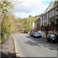
Isolated group of houses at the southern end of High Street, Llanhilleth
The houses on the east side of the B4471, here named High Street, are about 250 metres from the main part of High Street, ahead.
Image: © Jaggery
Taken: 6 Oct 2011
0.05 miles
3
Path up from Llanhilleth Colliery Memorial
Path on the edge of Granny's Wood from memorial
Image to derelict pithead baths.
Image: © M J Roscoe
Taken: 26 Jul 2022
0.05 miles
4
Path under road to Llanhilleth Colliery Memorial
The path goes down from the derelict pithead baths under the High Street, B4471, at Horseshoe Bend into Granny's Wood and to the memorial
Image
Image: © M J Roscoe
Taken: 26 Jul 2022
0.07 miles
5
Path up to derelict pithead baths
The path, the continuation of
Image, goes from Granny's Wood under the High Street bridge
Image
Image: © M J Roscoe
Taken: 26 Jul 2022
0.07 miles
6
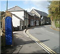
Inconspicuous Llanhilleth boundary sign
Dark blue letters on a dark blue background is not the best combination to grab attention! The view is along High Street looking towards Zion church on the bend.
Image: © Jaggery
Taken: 6 Oct 2011
0.08 miles
7
Derelict former pithead baths, Llanhilleth
Located on the east side of Horseshoe Bend, adjacent to High Street (B4471). Formerly part of the now closed Llanhilleth Colliery, the building has been derelict for nearly a decade. It was to be demolished after councillors in February 2008 approved plans to build housing here.
However, this view taken in early October 2011 shows that this has not happened.
Image: © Jaggery
Taken: 6 Oct 2011
0.08 miles
8
Entering Llanhilleth
Image: © Alan Hughes
Taken: 13 Aug 2024
0.08 miles
9
Derelict pit head baths, Llanhilleth
Former pit head baths beside the B4471 at Llanhilleth. The pit head baths served the former Llanhilleth Colliery which closed in 1969. After this the baths remained and were used intermittently by other companies for light industry.
Image: © Philip Halling
Taken: 10 Aug 2012
0.08 miles
10
Ordnance Survey Cut Mark
This OS cut mark can be found on the old Pithead Baths. It marks a point 164.741m above mean sea level.
Image: © Adrian Dust
Taken: 16 Aug 2021
0.09 miles


