1
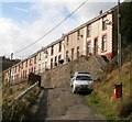
Lower Court Terrace, Llanhilleth
A view NE along Lower Court Terrace from the northern end of Springfield Terrace.
Image: © Jaggery
Taken: 6 Oct 2011
0.14 miles
2
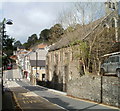
Hafodarthen Road, Llanhilleth
The steps on the left (leading up to Victoria Terrace) mark the end of Lower Court Terrace behind the camera, and the start of Hafodarthen Road ahead.
Image: © Jaggery
Taken: 6 Oct 2011
0.14 miles
3
Victoria Terrace, Llanhilleth
Viewed from the edge of Hafodarthen Road.
Image: © Jaggery
Taken: 6 Oct 2011
0.14 miles
4
The Walpole Arms
Anyone interested in some of the history of this pub can find information about landlords, clubs etc at https://outoftheblueartifacts.com/the-walpole-hotel-llanhilleth/
At one time there were plans for it to become a refuge for the homeless.
Image: © Alan Hughes
Taken: 13 Aug 2024
0.14 miles
5
Commercial Road houses, Llanhilleth
These houses, immediately west of the Conservative Club, http://www.geograph.org.uk/photo/2825476 are based a couple of metres above street level.
Image: © Jaggery
Taken: 6 Oct 2011
0.16 miles
6
Hillside houses, Brynithel
Situated on the eastern side of the Ebbw Valley and taken from a viewpoint on the other side of the valley.
Image: © Robin Drayton
Taken: 29 Feb 2012
0.16 miles
7
Llanhilleth post office
Currently (October 2011) located inside a Premier store on Commercial Road.
The previous post office, now vacant, is next door. http://www.geograph.org.uk/photo/2637011
The Premier store was previously a Londis.
Image: © Jaggery
Taken: 6 Oct 2011
0.16 miles
8
From High Street to Commercial Road, Llanhilleth
The zebra crossing is about the point at which High Street on the camera side becomes Commercial Road in the distance. On the right is St Mark's Church. http://www.geograph.org.uk/photo/2637248
Image: © Jaggery
Taken: 6 Oct 2011
0.16 miles
9
Llanhilleth Conservative & Unionist Club
Located at 20 Commercial Road, Llanhilleth.
Image: © Jaggery
Taken: 6 Oct 2011
0.16 miles
10
Looking SW along Hafodarthen Road, Llanhilleth
There is a two or three metre break in the terraced housing on a bend in Hafodarthen Road.
The gap at the right edge of the view is between number 55 and number 57.
Image: © Jaggery
Taken: 6 Oct 2011
0.16 miles


