1
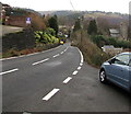
Overlooking Christchurch, Aberbeeg
Looking downhill towards the church tower in the Christchurch area of Aberbeeg.
Image: © M J Roscoe
Taken: 16 Dec 2016
0.02 miles
2
Road descending from Cwm Nant Gwynt towards Aberbeeg
From the northern edge of the hamlet of Cwm Nant Gwynt.
The hamlet's boundary sign http://www.geograph.org.uk/photo/5220622 is behind the camera.
Christchurch Aberbeeg is on the right.
Image: © Jaggery
Taken: 9 Dec 2016
0.04 miles
3
Cwm Nant Gwynt side road
The name sign shows that the dead-end side road leads to The Haven, Ty Ganol, Bellevue,
Kinra, Bryn Goch and Two Trees in Cwm Nant Gwynt, a hamlet in Caerphilly County Borough.
Image: © Jaggery
Taken: 9 Dec 2016
0.05 miles
4
Path down to Pantddu Fields, Aberbeeg
Steep footpath down from bus stop on Pantddu Road to cul-de-sac.
Image: © M J Roscoe
Taken: 16 Dec 2016
0.06 miles
5
Stile on path up towards Graig Fawr
An usual damaged metal stile with dog gate, the two steps are missing and mesh appears to have been removed from the dog gate. The woodland path is not designated as a public path.
Image: © M J Roscoe
Taken: 16 Dec 2016
0.08 miles
6
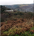
View from Trinant towards Aberbeeg
From this http://www.geograph.org.uk/photo/5234338 bench.
Image: © Jaggery
Taken: 19 Dec 2016
0.08 miles
7
View to Christchurch, Aberbeeg, from Trinant
Image: © Gareth James
Taken: 28 Dec 2016
0.08 miles
8
Northern boundary of Cwm Nant Gwynt
The road ascending from Aberbeeg reaches the hamlet of Cwm Nant Gwynt in Caerphilly County Borough.
The Welsh Cwm Nant Gwynt is literally the valley of the brook named Gwynt. Nant Gwynt is a nearby small tributary of the River Ebbw. http://www.geograph.org.uk/photo/5220627 to a closer view of the sign.
Image: © Jaggery
Taken: 9 Dec 2016
0.09 miles
9
Cwm Nant Gwynt boundary sign detail
Located here. http://www.geograph.org.uk/photo/5220622 I began my walk today in Aberbeeg in the county borough of Blaenau Gwent.
I did not see any boundary signs on the way, but this Cwm Nant Gwynt sign depicts the Caerphilly County Borough crest.
The ermine shield with blue invected chevron symbolises the natural beauty of the area.
The castle represents Caerphilly castle, one of the largest in Europe.
The Welsh red dragon holds a Celtic wheel cross, symbolising the long history of Christianity in the area.
Caerphilly's motto is "Working together for the good of all"
Image: © Jaggery
Taken: 9 Dec 2016
0.09 miles
10
Aberbeeg church
Image: © andy dolman
Taken: 3 Jan 2009
0.09 miles


