1
Ordnance Survey Cut Mark
This OS cut mark can be found on the wall east side of School Street. It marks a point 156.701m above mean sea level.
Image: © Adrian Dust
Taken: 4 Feb 2021
0.09 miles
2
Yellow grit/salt box, Gellihaf Road, Fleur-de-lis
Alongside the long ascent from the centre of Fleur-de-lis.
Image: © Jaggery
Taken: 16 May 2018
0.09 miles
3
Northern end of Castle Street, Fleur-de-lis
From Gellihaf Road, Castle Street descends towards Victoria Road.
Image: © Jaggery
Taken: 16 May 2018
0.09 miles
4
Towards the southeast end of Gellihaf Road, Fleur-de-lis
Out of shot ahead, Gellihaf Road ends at the A4049 junction.
Image: © Jaggery
Taken: 16 May 2018
0.09 miles
5
Castle Street, Fleur de Lys
Castle Street descends away from Gellihaf Road in Fleur de Lys,
a village adjacent to Pengam, to the SE of Blackwood.
Image: © Jaggery
Taken: 3 May 2013
0.09 miles
6
Lane towards School Street, Fleur-de-lis
Railings https://www.geograph.org.uk/photo/3444418 near the camera prevent motor vehicles accessing this route from Gellihaf Road to School Street.
Image: © Jaggery
Taken: 16 May 2018
0.09 miles
7
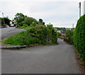
Blocked-off northern end of School Street, Fleur-de-lis
Viewed from Gellihaf Road in Fleur-de-lis, a village adjacent to Pengam, to the SE of Blackwood.
Image: © Jaggery
Taken: 3 May 2013
0.09 miles
8
Gellihaf Road houses and a long stone wall, Fleur-de-lis
The wall is above a slope descending to the valley of the Rhymney River.
Image: © Jaggery
Taken: 16 May 2018
0.10 miles
9
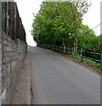
Wall, fence and railings, Fleur-de-lis
Alongside Gellihaf Road on the ascent away from the centre of Fleur-de-lis.
Image: © Jaggery
Taken: 16 May 2018
0.10 miles
10
Slow on Gellihaf Road, Fleur de Lys
Gellihaf Road descends past the Bryngwyn Road junction towards the centre of Fleur de Lys,
a village adjacent to Pengam, to the SE of Blackwood. Araf is Welsh for slow.
Image: © Jaggery
Taken: 3 May 2013
0.10 miles


