1
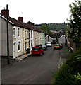
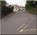
Plasgwyn Terrace, Fleur-de-lis
From the west side of the A4049, Plasgwyn Terrace descends towards Plas Road.
Image: © Jaggery
Taken: 16 May 2018
0.01 miles
2
Bus stops and shelters alongside the A4049, Fleur-de-lis
On bus route 14, jointly operated by Stagecoach and Harris Coaches.
The stop on the left is for buses to Blackwood via Cefn Fforest.
The stop on the right is for buses to Bargoed via Tir-y-Berth.
Image: © Jaggery
Taken: 16 May 2018
0.04 miles
3
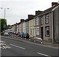
Bryngwyn Street houses, Fleur-de-lis
Viewed across the A4049.
Image: © Jaggery
Taken: 16 May 2018
0.04 miles
4
A side arm of Plas Road, Fleur de Lys
The side arm heads south away from the main course of Plas Road towards Plas Newydd and Plasgwyn Terrace in Fleur de Lys, a village adjacent to Pengam, to the SE of Blackwood.
Image: © Jaggery
Taken: 3 May 2013
0.05 miles
5
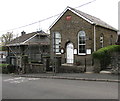
Mount Zion Methodist Church, Fleur-de-lis
Situated in Gellihaf Road
The plaque states "MOUNT ZION Primitive Methedist Chapel Erected AD 1870".
The correct spelling of Methodist appears above the door and on the noticeboard.
Image: © Robin Drayton
Taken: 23 Jan 2010
0.06 miles
6
Western end of Mount Pleasant, Fleur-de-lis
Cul-de-sac viewed across Gellihaf Road.
Image: © Jaggery
Taken: 16 May 2018
0.06 miles
7
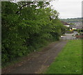
Path to Mount Pleasant, Fleur-de-lis
Descending from the west side of the A4049.
Image: © Jaggery
Taken: 16 May 2018
0.06 miles
8
Mount Zion Methodist Church, Gellihaf Road, Fleur-de-lis
Part of the Mid Glamorgan Mission Methodist Circuit.
The plaque https://www.geograph.org.uk/photo/5775626 on the wall records that the church was erected in 1870.
Image: © Jaggery
Taken: 16 May 2018
0.06 miles
9
1870 plaque on Mount Zion Methodist Church, Gellihaf Road, Fleur-de-lis
On the wall of this church. https://www.geograph.org.uk/photo/5775619 Methedist is an error for Methodist.
In 2018 the church name is Mount Zion Methodist Church.
Image: © Jaggery
Taken: 16 May 2018
0.06 miles
10
Plas Road, Fleur-de-lis
Plas Road ascends from High Street past the Gellihaf Road junction on the right.
The Ivor Street junction is ahead on the left.
Image: © Jaggery
Taken: 11 May 2018
0.06 miles


