1
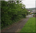
Path to Mount Pleasant, Fleur-de-lis
Descending from the west side of the A4049.
Image: © Jaggery
Taken: 16 May 2018
0.02 miles
2
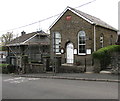
Mount Zion Methodist Church, Fleur-de-lis
Situated in Gellihaf Road
The plaque states "MOUNT ZION Primitive Methedist Chapel Erected AD 1870".
The correct spelling of Methodist appears above the door and on the noticeboard.
Image: © Robin Drayton
Taken: 23 Jan 2010
0.02 miles
3
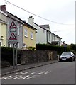
Western end of Mount Pleasant, Fleur-de-lis
Cul-de-sac viewed across Gellihaf Road.
Image: © Jaggery
Taken: 16 May 2018
0.02 miles
4
Gellihaf Road parking area, Fleur-de-lis
Extending to the corner of Castle Road, the parking area is on the left here. https://www.geograph.org.uk/photo/6136979
Image: © Jaggery
Taken: 16 May 2018
0.03 miles
5
Gellihaf Road houses, Fleur-de-lis
Between Mount Zion Methodist Church https://www.geograph.org.uk/photo/5775619 and the corner of Mount Pleasant.
Image: © Jaggery
Taken: 16 May 2018
0.03 miles
6
Mount Zion Methodist Church, Gellihaf Road, Fleur-de-lis
Part of the Mid Glamorgan Mission Methodist Circuit.
The plaque https://www.geograph.org.uk/photo/5775626 on the wall records that the church was erected in 1870.
Image: © Jaggery
Taken: 16 May 2018
0.05 miles
7
1870 plaque on Mount Zion Methodist Church, Gellihaf Road, Fleur-de-lis
On the wall of this church. https://www.geograph.org.uk/photo/5775619 Methedist is an error for Methodist.
In 2018 the church name is Mount Zion Methodist Church.
Image: © Jaggery
Taken: 16 May 2018
0.05 miles
8
Gellihaf Road houses and a long stone wall, Fleur-de-lis
The wall is above a slope descending to the valley of the Rhymney River.
Image: © Jaggery
Taken: 16 May 2018
0.05 miles
9
Castle Street, Fleur de Lys
Castle Street descends away from Gellihaf Road in Fleur de Lys,
a village adjacent to Pengam, to the SE of Blackwood.
Image: © Jaggery
Taken: 3 May 2013
0.05 miles
10
Warning signs alongside Gellihaf Road, Fleur-de-lis
Showing Patrol and No footway for 200 yds.
The English/Welsh words SLOW/ARAF are painted on the road surface.
The car is near the corner of Mount Pleasant. https://www.geograph.org.uk/photo/5775669
Image: © Jaggery
Taken: 16 May 2018
0.05 miles


