1
Sirhowy upstream of a footbridge north of Ynysddu
The river flows towards this http://www.geograph.org.uk/photo/2839808 footbridge.
Image: © Jaggery
Taken: 7 Apr 2011
0.06 miles
2
Disused flight of steps up a Sirhowy valley hillside north of Ynysddu
The NO ACCESS message on a broken white barrier is enforced by wire meshing blocking passage up the steps. Viewed from near a footbridge http://www.geograph.org.uk/photo/2839808 across the River Sirhowy.
Image: © Jaggery
Taken: 7 Apr 2011
0.06 miles
3
Footbridge across the Sirhowy north of Ynysddu
The footbridge is between Newport Road and a disused flight of steps. http://www.geograph.org.uk/photo/2839799
Image: © Jaggery
Taken: 7 Apr 2011
0.06 miles
4
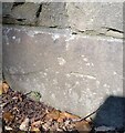
Ordnance Survey Cut Mark
This OS cut mark can be found on the west parapet of Pont Islwyn. It marks a point 115.894m above mean sea level.
Image: © Adrian Dust
Taken: 23 Jun 2021
0.07 miles
5
Sirhowy flows towards Pont Islwyn north of Ynysddu
The river flows under the bridge, Pont Islwyn, http://www.geograph.org.uk/photo/2839853 carrying Newport Road.
Image: © Jaggery
Taken: 7 Apr 2011
0.07 miles
6
Sirhowy downstream from a footbridge north of Ynysddu
The river flows away from this http://www.geograph.org.uk/photo/2839808 footbridge.
Image: © Jaggery
Taken: 7 Apr 2011
0.07 miles
7
Pont Islwyn north of Ynysddu
Opened in 1928, http://www.geograph.org.uk/photo/2839842 the bridge carries Newport Road over the River Sirhowy, between Pontllanfraith and Ynysddu.
Image: © Jaggery
Taken: 7 Apr 2011
0.07 miles
8
Twyn Gwyn Road
Tree-lined minor rural road on a hillside.
Image: © M J Roscoe
Taken: 17 Nov 2018
0.10 miles
9
Stream above Twyn Gwyn Road
Woodland stream between two fields viewed from almost the same position as
Image
Image: © M J Roscoe
Taken: 17 Nov 2018
0.10 miles
10
Footpath and cycle route south of Pontllanfraith
The path was formery a railway from Pontllanfraith to Ynysddu and beyond. A bridge http://www.geograph.org.uk/photo/2839694 is behind the camera.
Image: © Jaggery
Taken: 7 Apr 2011
0.12 miles


