1
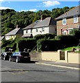
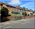
Glanhowy Road semis, Wyllie
Semi-detached houses set above road level.
Image: © Jaggery
Taken: 24 Sep 2018
0.04 miles
2
Wyllie: post office
This post office is threatened with closure in the spring of 2008. This was a classic candidate to join 2,500 others in the UK this year, open 10 hours a week, reporting weekly custom of fewer than 50 transactions per week, and within 1½ miles of two alternative branches.
Image: © Chris Downer
Taken: 16 Feb 2008
0.04 miles
3
Wyllie houses
Semi-detached houses set above Glanhowy Road in Wyllie.
Image: © Jaggery
Taken: 24 Sep 2018
0.05 miles
4
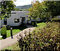
Entrance to Coed y Cwm, Wyllie
Located below the east side of Glenhowy Road, Coed y Cwm is
a community day centre for people with learning difficulties.
Image: © Jaggery
Taken: 24 Sep 2018
0.05 miles
5
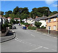
The Avenue, Wyllie
Ascending from Glanhowy Road.
Image: © Jaggery
Taken: 24 Sep 2018
0.05 miles
6
Marion Jones Court, Wyllie
Managed by Derwen Cymru, Marion Jones Court is retirement housing built in 1993.
This part of Marion Jones Court, on the corner of The Avenue and Glanhowy Road,
was formerly occupied by Wyllie Methodist Chapel.
Image: © Jaggery
Taken: 24 Sep 2018
0.06 miles
7
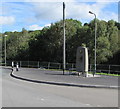
Wyllie War Memorial
Alongside Glanhowy Road opposite The Avenue, viewed in September 2018.
An April 2011 Google Earth Street View shows a BT phonebox where the Memorial is now.
Image: © Jaggery
Taken: 24 Sep 2018
0.06 miles
8
NCN Route 47 near Wyllie
Image: © Gareth James
Taken: 27 Mar 2011
0.07 miles
9
West side of Glanhowy Road, Wyllie
These houses above the west side of Glanhowy Road are near a bus stop https://www.geograph.org.uk/photo/5917494 for buses to Blackwood.
Image: © Jaggery
Taken: 24 Sep 2018
0.07 miles
10
Glanhowy Road bus stop and shelter, Wyllie
The stop near the corner of The Avenue is on bus route 6 to Blackwood bus station via Gelligroes and Pontllanfraith. In September 2018 buses on this route are operated by Harris Coaches.
Image: © Jaggery
Taken: 24 Sep 2018
0.07 miles


