IMAGES TAKEN NEAR TO
St. Peters Drive, BLACKWOOD, NP12 2ER
Introduction
This page details the photographs taken nearby to St. Peters Drive, NP12 2ER by members of the Geograph project.
The Geograph project started in 2005 with the aim of publishing, organising and preserving representative images for every square kilometre of Great Britain, Ireland and the Isle of Man.

There are currently over 7.5m images from over14,400 individuals and you can help contribute to the project by visiting https://www.geograph.org.uk
Image Map
Images are licensed for reuse under creativecommons.org/licenses/by-sa/2.0
Notes
- Clicking on the map will re-center to the selected point.
- The higher the marker number, the further away the image location is from the centre of the postcode.
Image Listing (9 Images Found)
Images are licensed for reuse under creativecommons.org/licenses/by-sa/2.0
Image
Details
Distance
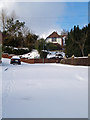
1
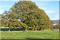
Line of trees by playing field, Pontllanfraith Leisure Centre
Oak trees.
Image: © M J Roscoe
Taken: 2 Nov 2021
0.18 miles
2
Southern edge of Libanus Primary School, Blackwood
The school http://www.geograph.org.uk/photo/2425798 occupies a site 110 metres long by 50 metres wide on the west side of Libanus Road.
Image: © Jaggery
Taken: 24 May 2011
0.20 miles
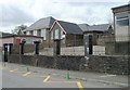
3
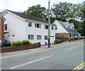
Libanus Road houses, Blackwood
The houses are on the southern section of Libanus Road, which runs west to east, viewed from near the corner of the T-junction with the section of Libanus Road which runs roughly north to south.
Image: © Jaggery
Taken: 24 May 2011
0.20 miles
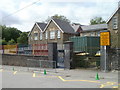
4
Divisional Police Headquarters, Blackwood
Part of the Gwent Police Force, viewed across Blackwood Road near the Blackwood/Pontllanfraith boundary.
Image: © Jaggery
Taken: 22 Aug 2013
0.21 miles
6
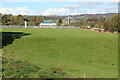
Playing field, Pontllanfraith Leisure Centre
Next to the flat field is Blackwood Police Station. The pylon of Chartist Bridge is beyond.
Image: © M J Roscoe
Taken: 2 Nov 2021
0.21 miles
7
Libanus Primary School, Blackwood
Located on the west side of Libanus Road.
Image: © Jaggery
Taken: 24 May 2011
0.22 miles
8
Divisional Police Headquarters, Blackwood
Image: © John Lord
Taken: 24 Aug 2017
0.22 miles
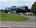
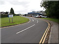
9
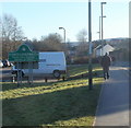
Walking into Pontllanfraith
The view along a pavement adjacent to a small car park on the east side of Blackwood Road (A4048). Pontllanfraith is a large village adjoining the southern edge of Blackwood.
Image: © Jaggery
Taken: 20 Jan 2011
0.25 miles