1
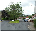
Path to Cwm Philkins, Pontllanfraith
Viewed from near the Newbridge Road end, a path heads towards Cwm Philkins, the site of a former Sirhowy Valley colliery. A variant spelling is Filkins.
Image: © Jaggery
Taken: 23 Jan 2011
0.06 miles
2
Ivor Arms Pontllanfraith
Pub located on the south side of Newbridge Road near the corner of Millbrook Road.
Image: © Jaggery
Taken: 8 Aug 2012
0.10 miles
3
Meadow Road, Springfield, Pontllanfraith
Houses on the north side of the road viewed from the corner of Millbrook Road.
Image: © Jaggery
Taken: 8 Aug 2012
0.11 miles
4
Flooring retailers, Pontllanfraith
Quick Step Laminate Floor Centre and next door, Carpet & Flooring Store, located on the south side of Newbridge Road.
Image: © Jaggery
Taken: 23 Jan 2011
0.12 miles
5
Ivor Arms, Pontllanfraith
Pub on the south side of Newbridge Road (B4251) viewed from the corner of the eastern arm of Elim Way.
Image: © Jaggery
Taken: 7 Apr 2011
0.12 miles
6
Northern boundary of Springfield, Pontllanfraith
Viewed across Newbridge Road (B4251). Millbrook Road heads south into the Springfield district of Pontllanfraith.
Image: © Jaggery
Taken: 8 Aug 2012
0.15 miles
7
Sainsbury's filling station, Pontllanfraith
Located at the western end of Sainsbury's superstore http://www.geograph.org.uk/photo/2016911 which opened on the former Somerfield site on the north side of Newbridge Road in 2009.
Image: © Jaggery
Taken: 16 Aug 2010
0.16 miles
8
Pontllanfraith Primary School
Viewed across Penmaen Road. The Infants part of the school is on the right.
Image: © Jaggery
Taken: 8 Aug 2012
0.17 miles
9
Cwm Braenar, Pontllanfraith
Cwm Braenar houses viewed from the corner of Vicarage Lane.
Image: © Jaggery
Taken: 8 Aug 2012
0.17 miles
10
Trees on a grassy island in Millbrook Road, Springfield, Pontllanfraith
Two oaks, much older than the surrounding houses,
are in a 35-metre long island in the middle of Millbrook Road.
Image: © Jaggery
Taken: 8 Aug 2012
0.18 miles


