1
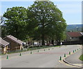
Brick houses with tiled roofs, Apollo Way, Blackwood
Viewed from the corner of Parfitt Place.
Image: © Jaggery
Taken: 17 May 2018
0.02 miles
2
East side of Parfitt Place, Blackwood
Parfitt Place is a cul-de-sac on the south side of Apollo Way.
The houses on this side are set slightly below road level, accessed by the steps seen here. https://www.geograph.org.uk/photo/5776933
Image: © Jaggery
Taken: 17 May 2018
0.02 miles
3
Junction of Parfitt Place and Apollo Way, Blackwood
Parfitt Place from the right (south) joins Apollo Way.
Image: © Jaggery
Taken: 17 May 2018
0.03 miles
4
Entrance to Blackwood Primary School
Viewed across Apollo Way.
Image: © Jaggery
Taken: 4 Apr 2011
0.03 miles
5
West side of Parfitt Place, Blackwood
Parfitt Place is a cul-de-sac on the south side of Apollo Way.
Image: © Jaggery
Taken: 17 May 2018
0.03 miles
6
Chartist Way, Blackwood
The southern end of Chartist Way viewed across Apollo Way.
Image: © Jaggery
Taken: 17 May 2018
0.04 miles
7
Apollo Way house scaffolding, Blackwood
In place in mid May 2018. Two red speed bumps are on the right.
Image: © Jaggery
Taken: 17 May 2018
0.04 miles
8
East side of Croeso Square, Blackwood
Looking north across Apollo Way.
Image: © Jaggery
Taken: 17 May 2018
0.05 miles
9
Apollo Way bungalows set below road level, Blackwood
Originally, bungalow was used in English for a lightly-built house, with a veranda and one storey.
In current UK usage it is a convenient word for any one-storey dwelling.
The green cones are part of the Keep Clear Zone (no stopping or parking) near Blackwood Primary School.
Image: © Jaggery
Taken: 17 May 2018
0.05 miles
10
Two rows of green cones, Apollo Way, Blackwood
The cones mark the no parking/no stopping zone near the entrance to Blackwood Primary School.
Image: © Jaggery
Taken: 17 May 2018
0.05 miles


