1
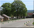
Albany Road, Blackwood
Houses on the west side of Albany Road, viewed from the Attlee Road / Woodbine Road junction.
Image: © Jaggery
Taken: 4 Apr 2011
0.10 miles
2
Apollo Way, Blackwood
Viewed from near the entrance http://www.geograph.org.uk/photo/2341484 to Blackwood Primary School.
Image: © Jaggery
Taken: 4 Apr 2011
0.11 miles
3
Entrance to Blackwood Primary School
Viewed across Apollo Way.
Image: © Jaggery
Taken: 4 Apr 2011
0.11 miles
4
West side of Parfitt Place, Blackwood
Parfitt Place is a cul-de-sac on the south side of Apollo Way.
Image: © Jaggery
Taken: 17 May 2018
0.12 miles
5
East side of Parfitt Place, Blackwood
Parfitt Place is a cul-de-sac on the south side of Apollo Way.
The houses on this side are set slightly below road level, accessed by the steps seen here. https://www.geograph.org.uk/photo/5776933
Image: © Jaggery
Taken: 17 May 2018
0.12 miles
6
Junction of Parfitt Place and Apollo Way, Blackwood
Parfitt Place from the right (south) joins Apollo Way.
Image: © Jaggery
Taken: 17 May 2018
0.14 miles
7
Two rows of green cones, Apollo Way, Blackwood
The cones mark the no parking/no stopping zone near the entrance to Blackwood Primary School.
Image: © Jaggery
Taken: 17 May 2018
0.15 miles
8
Apollo Way house scaffolding, Blackwood
In place in mid May 2018. Two red speed bumps are on the right.
Image: © Jaggery
Taken: 17 May 2018
0.15 miles
9
Red Hot Goodies, Apollo Way, Blackwood
In May 2018 the Chinese takeaway is next door to Apollo Way Convenience Store, a Premier Express store.
An August 2011 Google Earth Street View shows a Costcutter convenience store next door to Red Hot Goodies.
Image: © Jaggery
Taken: 17 May 2018
0.15 miles
10
Albany Road and Attlee Road, Blackwood
A view along Albany Road into Attlee Road. The right turn just past
the bus stop into Woodbine Road is the point at which the name change occurs.
Image: © Jaggery
Taken: 1 May 2013
0.16 miles


